
Getting there
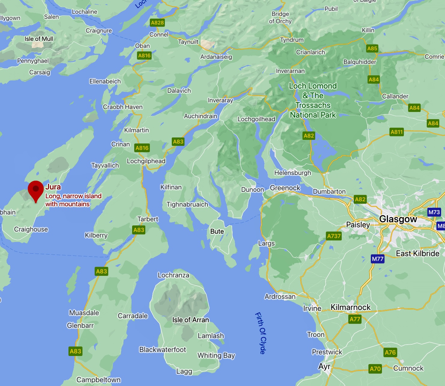
To reach Jura you must first go to Islay either a flight from Glasgow or mainland ferry from Kennacraig to Port Ellen or Port Askaig. Flight takes an hour whilst the ferry is approximately two hours.
If your plan is to go directly to Jura, Port Askaig should be your preferred destination as the ferry to Jura leaves from here. It’s a ten minute trip across the Sound of Jura to Feolin.
There is a regular ferry across to Jura albeit at slightly irregular times, it runs more or less hourly.
Adventure on Jura
Ten years ago I would have struggled to name ten Scottish islands although Jura was among the ones I could name. I remembered The KLF (an electronic band aka The Justified Ancients of Mu-Mu) burning a million pounds there in the early nineties and some vague fragment of recollection regarding George Orwell.
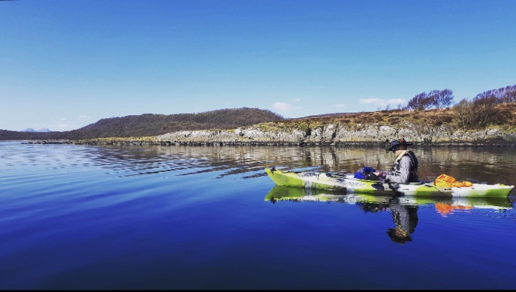
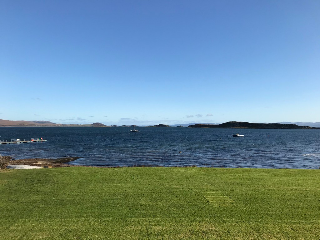
My nephew Sam and I took a spring 2019 kayaking trip to Loch Sween spending a few days exploring the loch, the main days paddling was through water as still as it was in the photograph. The aptly named Paps of Jura visible almost the entire way down Loch Sween.
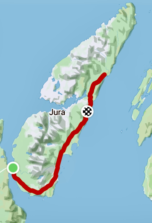
This trip prompted much research on Jura, looking into the cycling or kayaking possibilities which very quickly focussed on cycling the entire island on its only road and seeing the Corryvreckan.
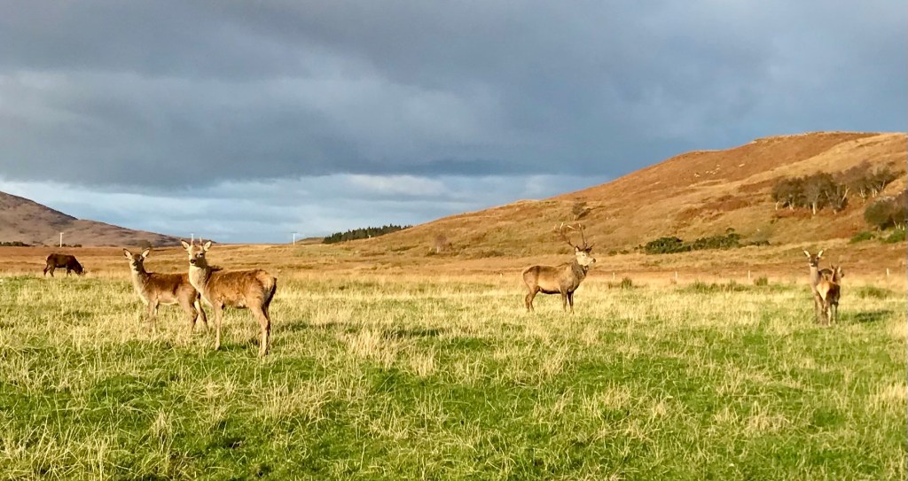
Jura or Diùra in Gaelic, meaning island of deers.
The Gulf of Corryvreckan (Gaelic Coire Bhreacain) which translates as “cauldron of the speckled seas” is a narrow strait between the islands of Jura and Scarba, it’s also the third largest whirlpool in the world. Flood tides and inflow from the Firth of Lorne can drive the waters of Corryvreckan to waves of more than 30 feet high, the roar of which can often be heard 10 miles away.
In August 1947 George Orwell and his three year old son were shipwrecked after getting into trouble on the gulf, taking refuge on a skerry Eilean Mòr which is just south of the whirlpool. Orwell finished his first draft of 1984 three months after this incident whilst living at Barnhill.
Bizarrely and somewhat impressively the first recorded swim across the whirlpool was by Bill Dunn, the one-legged brother-in-law of George Orwell. Bill smeared himself in sheep fat to prevent hypothermia
Two of my favourite tools for researching routes are OS maps & Google Earth. I’ll follow Street View to check all or parts of a route. In some of the remote areas people will leave photo spheres. It’s a great way to delve into hard to get to locations and giving yourself a sense of the environment before visiting.
In researching routes I noticed that one person kept popping up in locations I’d visited or wanted to visit all over Scotland, in some very remote lochs and mountains.
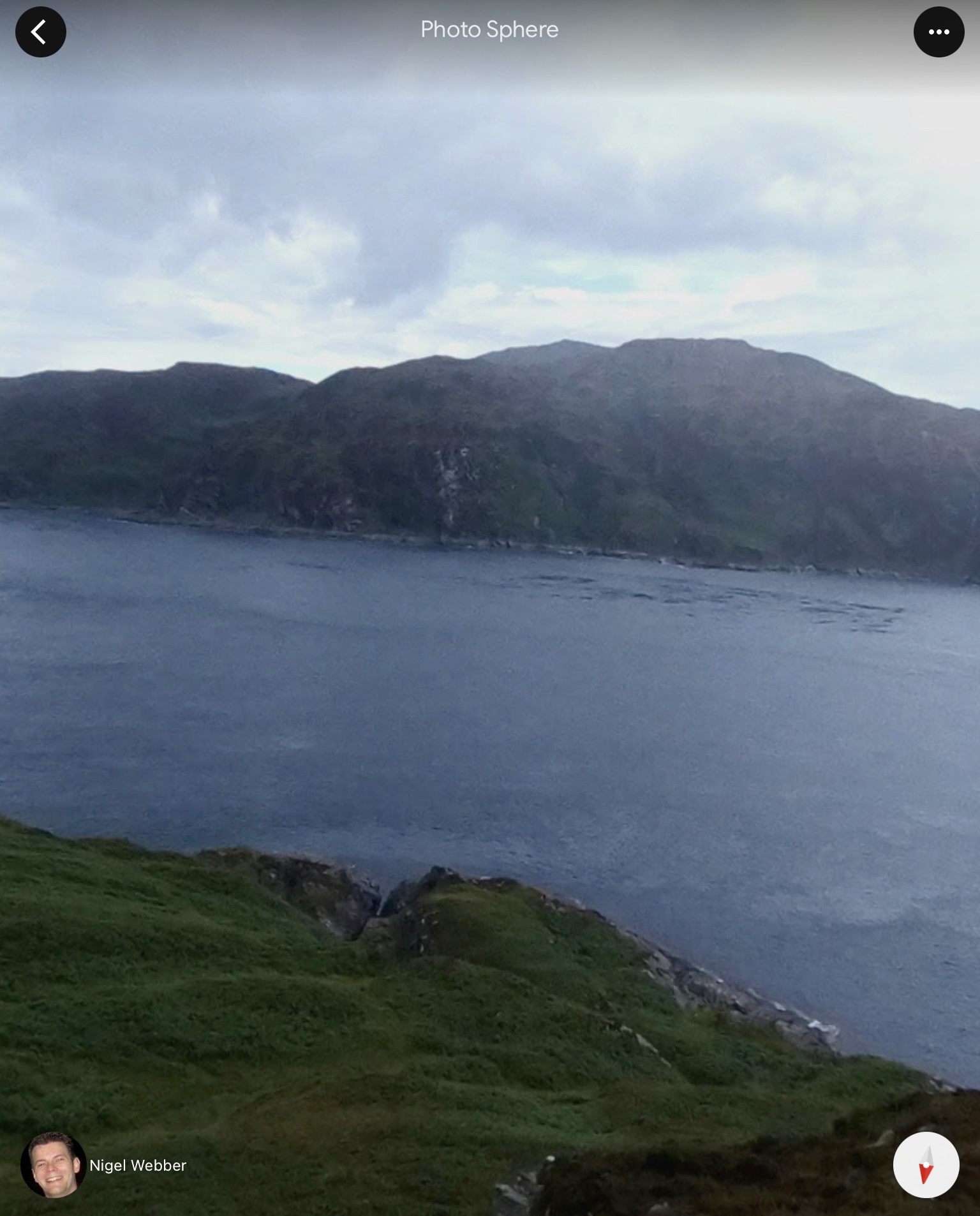
This guy is amazing, the 360’s he has posted to Google Earth are unbelievably helpful, I first spotted his pictures of Loch Laidon which helped me plan another trip.
So this is Nigel standing on the hill overlooking the Gulf of Corryvreckan.
I wanted to stand on that hill.
Islay
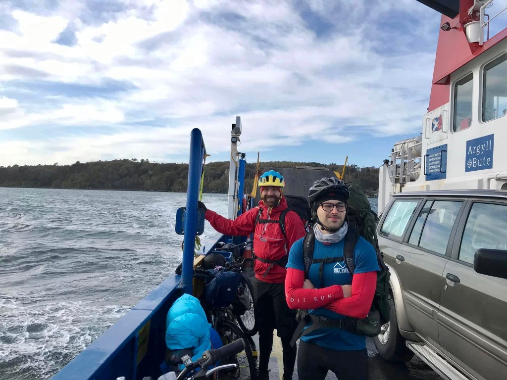
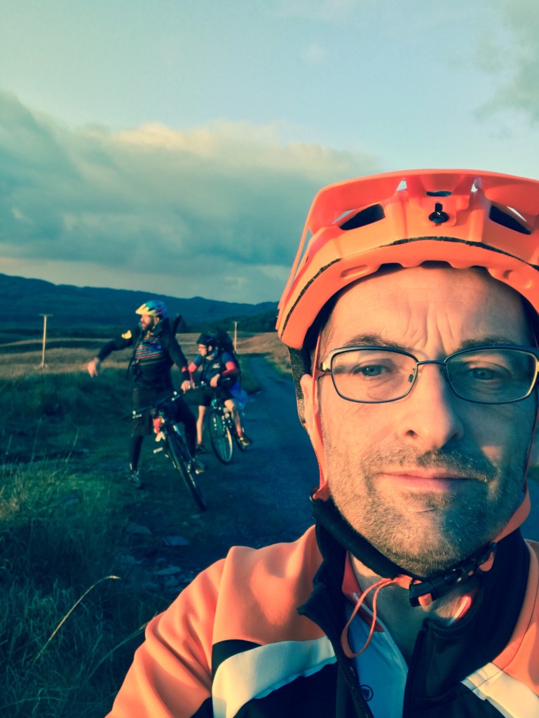
Late September 2019 myself, Sam and my brother in law Andrew headed off at from the North West at 10pm intending to camp somewhere near Kennacraig. This was a six hour drive meaning we’d arrive in the general area around 4am find somewhere to camp and have maybe four hours sleep before needing to be at the ferry terminal. Finding a suitable site out of the way was more difficult than I imagined eventually settling on a site near a quiet road.
Islay otherwise known as The Queen of the Hebrides is on my list of place to visit. It’s one of the six whisky producing regions of Scotland. Speyside, Highlands, Islands, Campbeltown and the Lowlands being the others.
With the island only being 25 miles long and already eight distilleries with another two planned it makes for an excellent whisky tour.
We arrived at Port Askaig just after 11am and spent 45 minutes waiting for the Jura ferry so really didn’t get to see much of Islay at all. Just long enough to get supplies from the local shop.
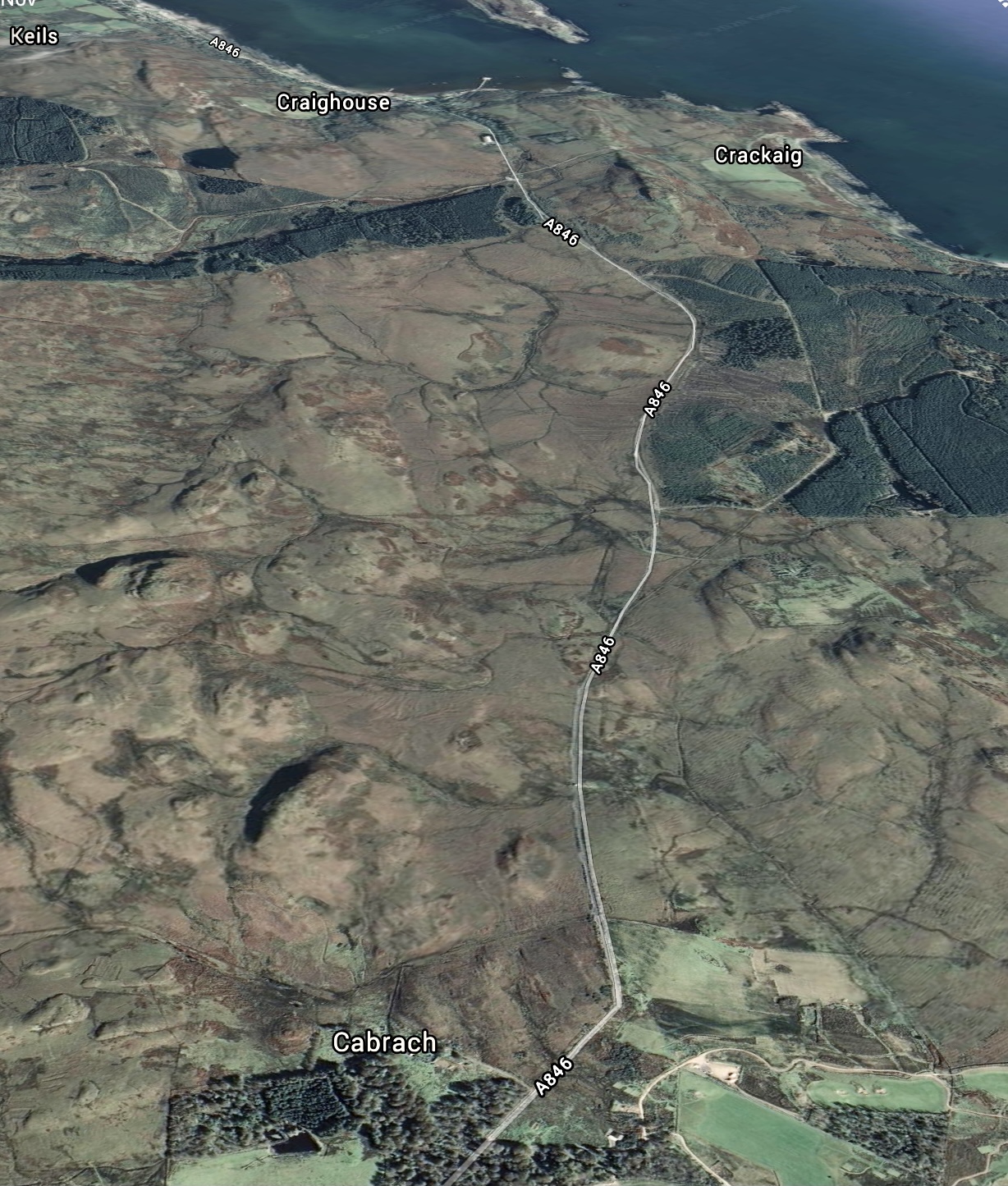
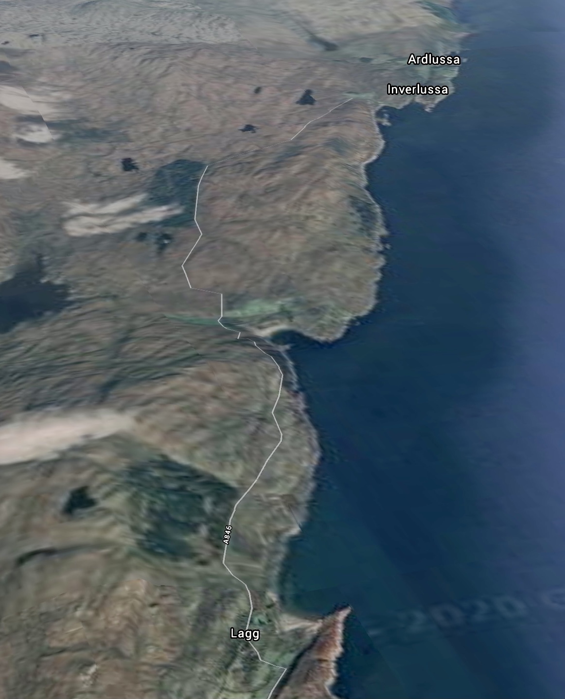
Feolin Ferry to Jura House
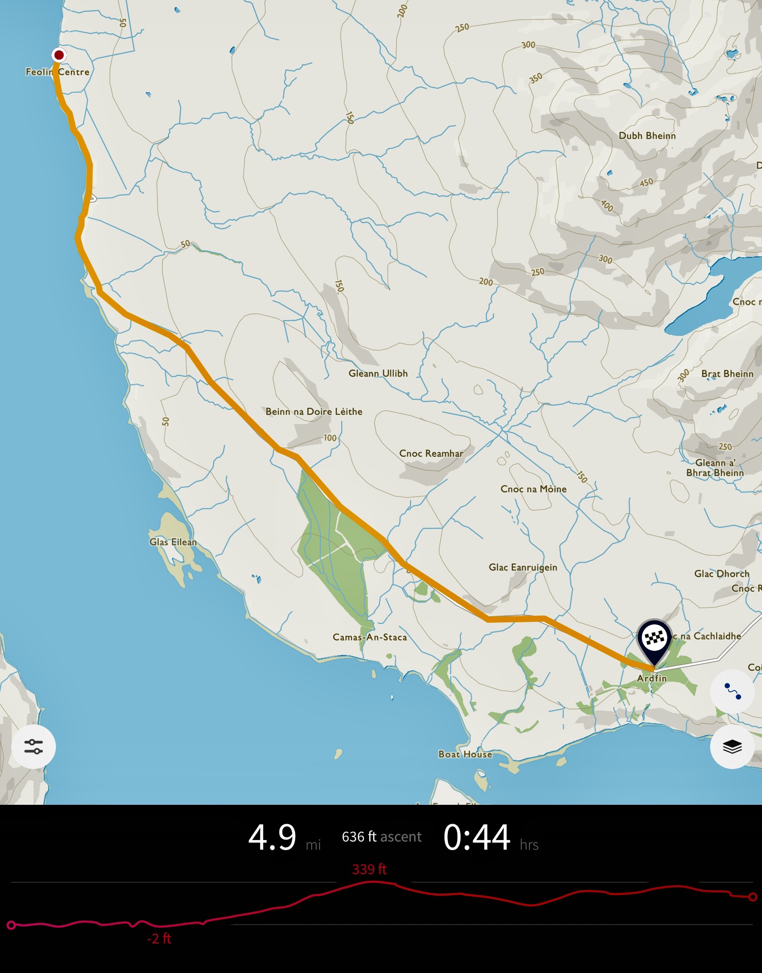
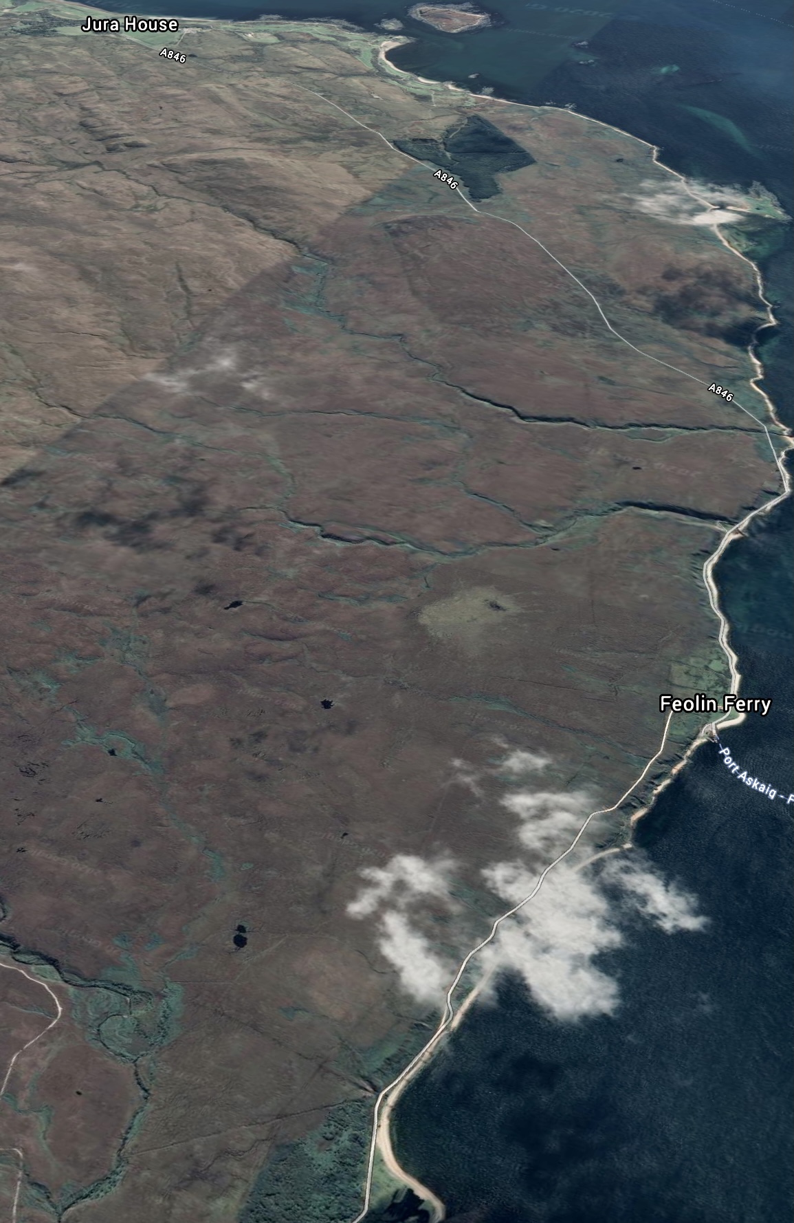
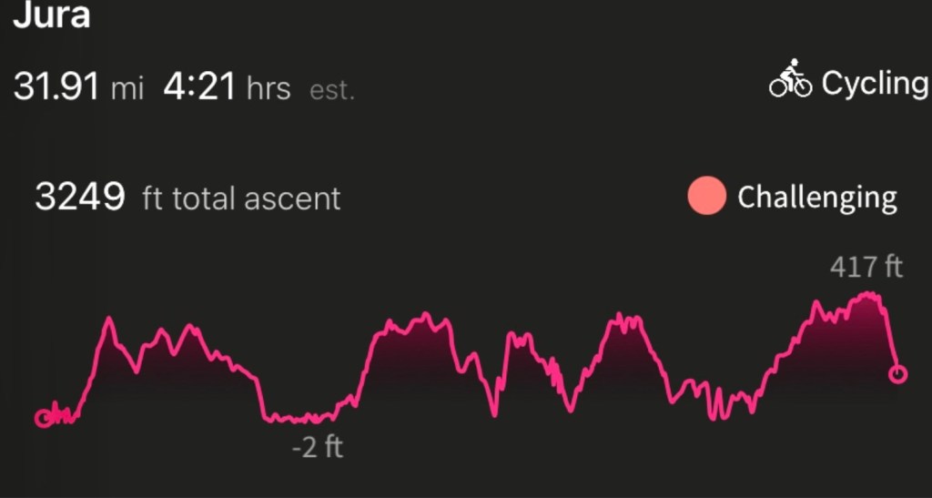
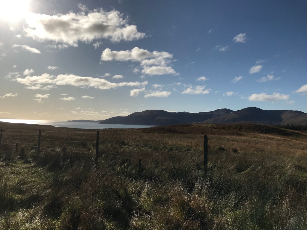
Fifty or so miles between Feolin and The Corryvreckan, the public road ends three miles after Ardlussa bay whereupon a private track takes you most of the way to the end of the island.
The weather couldn’t have been much better, plenty of sunshine and whilst there was a chilly breeze we were glad of it once we started cycling, helpfully the first few miles were reasonably flat. McDougall’s bay to the right of us we quickly reached the Abhainn Mhor and after this began a long steady climb of 339 feet before descending towards Jura House.
The burnt orange colours of Autumn dominated the landscape on our trip along with the deep bellowing of stags, Andrew has this noise down to a tee.

Jura House to Craighouse
From here on in we saw numerous golden eagles. A number of times stopping to watch them in flight and to rest legs after the long slow climb, on the journey back we were lucky enough to see one up close swooping through the trees near Jura House.
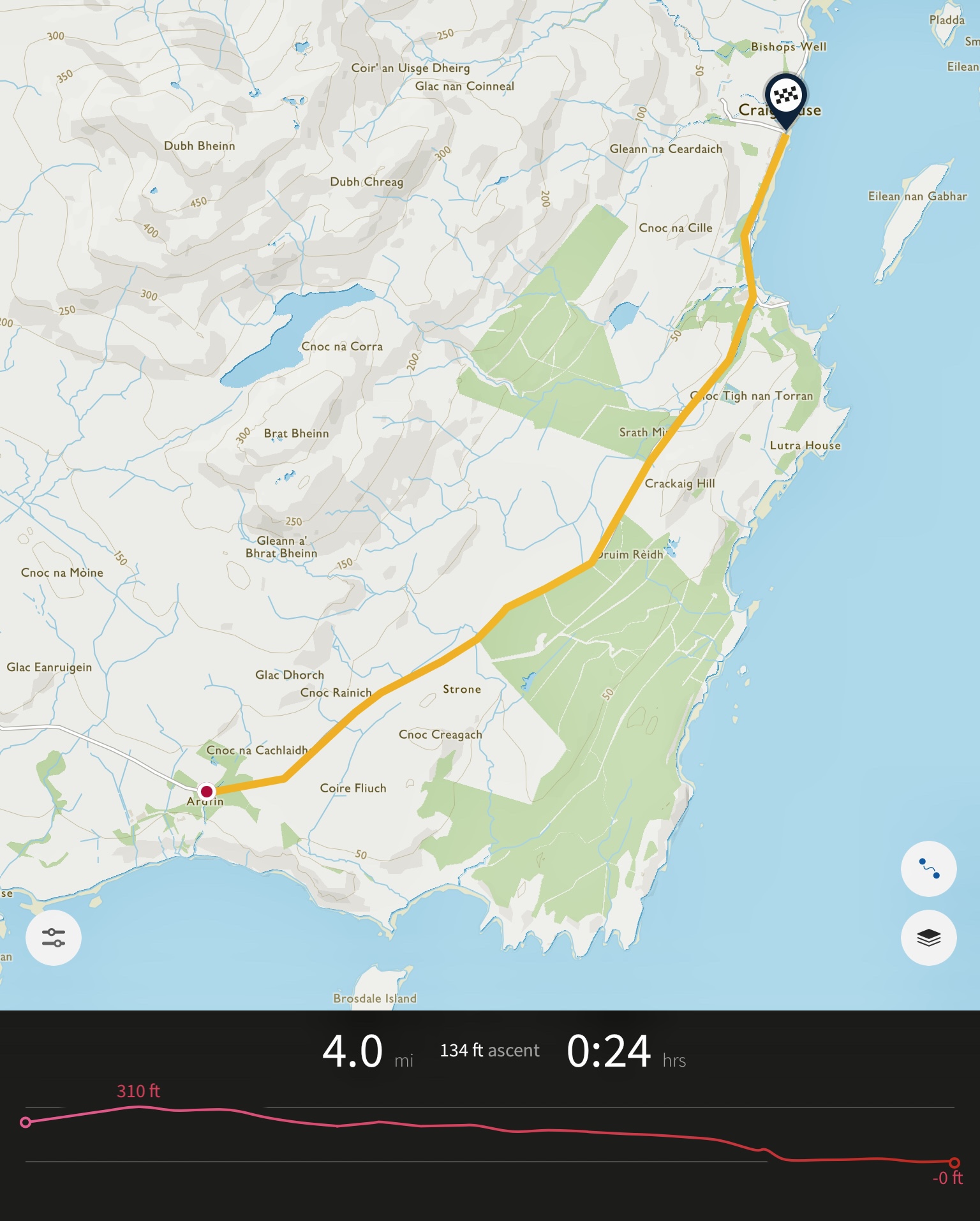
After that we were out in the open pedalling a gentle incline towards Craighouse.
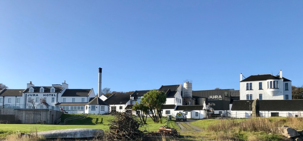
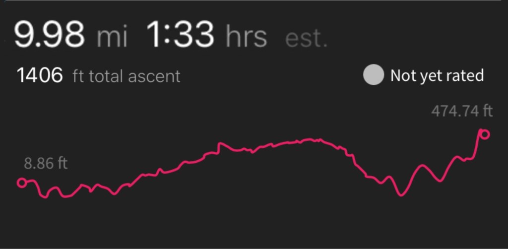
It had taken us longer than expected to reach Craighouse, nine miles in ninety minutes. The additional loads we had slowing the pace down along with at least two hard slog climbs already. A sharp downhill takes you into the village starting with the distillery and hotel followed by a row of white cottages.
It was very white and very clean with an amazing view across the Bay of Small Isles. A bit of a rest and refuel and a quick visit to the distillery shop. Unfortunately the visit shop was closed which meant no black pudding for breakfast.
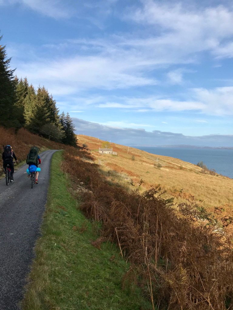
Craighouse to Leargybreck
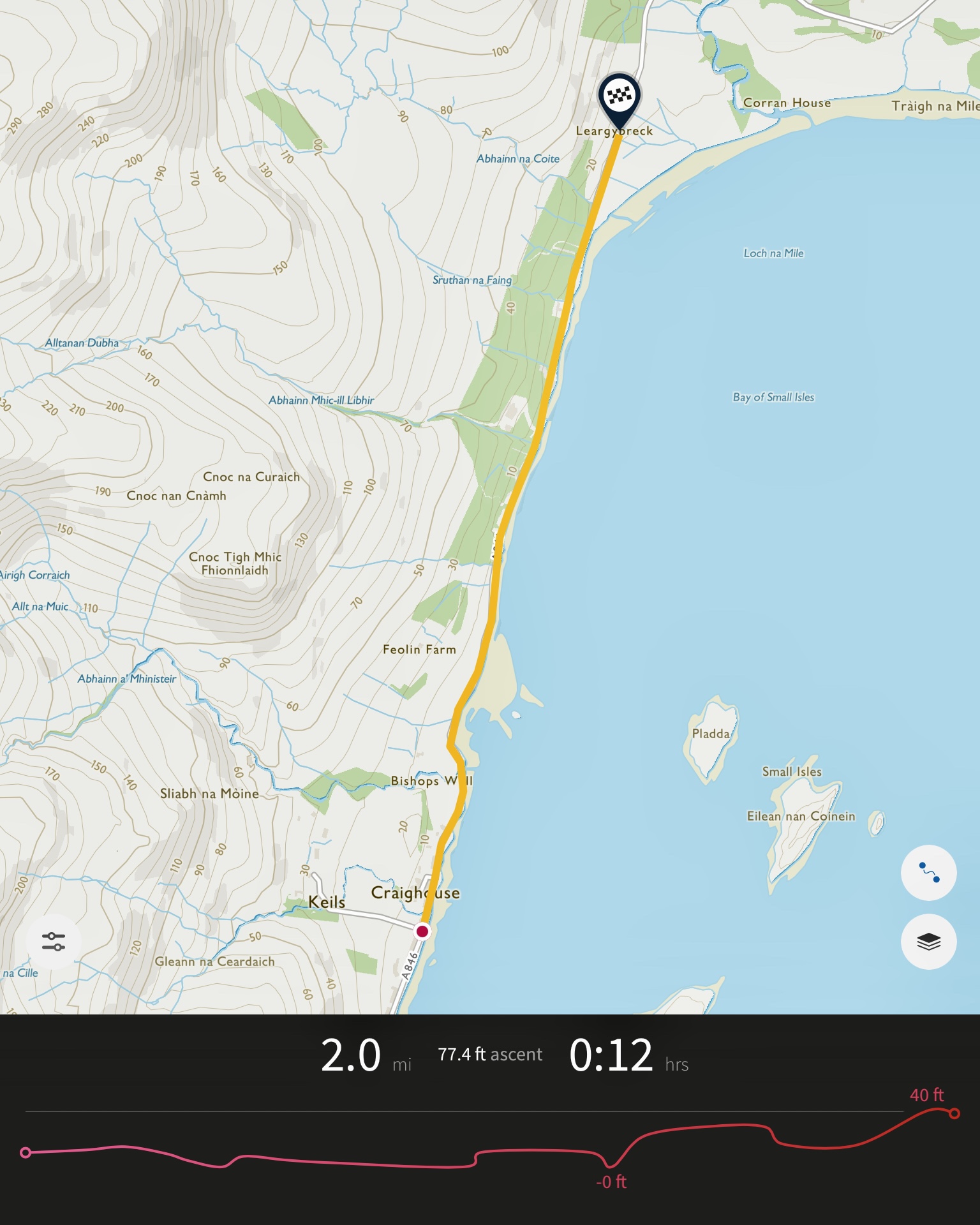
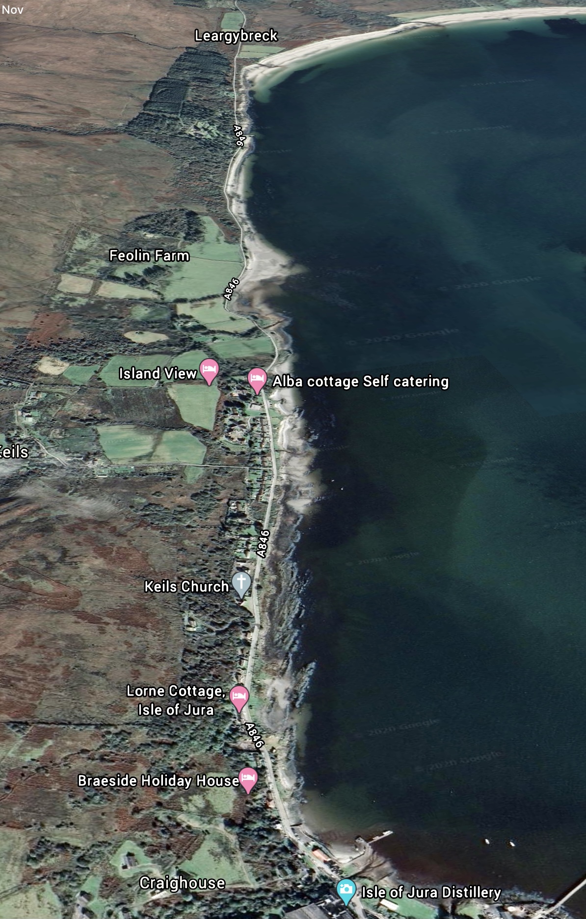
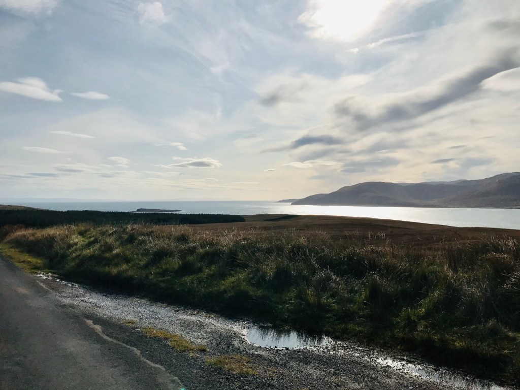
By far the easiest part of the trip, ambling along at sea level past more cottages. Leaving Craighouse behind we got a good view of The Paps just before Feolin farm. Paps is an ancient word from Old Norse meaning breasts which is exactly what they look like.
From here the left was filled by the Jura forest as we wound our way along the coastal path.
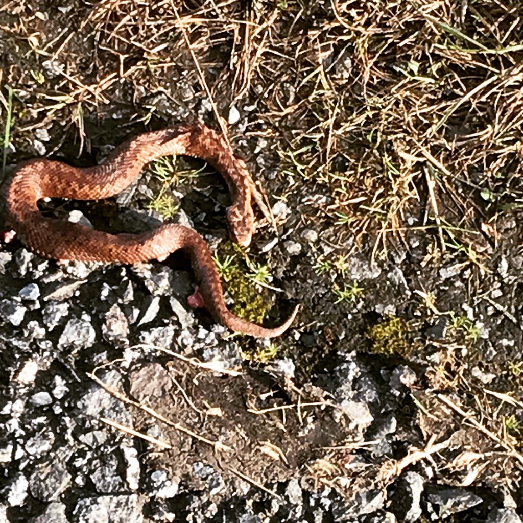
We were moving quickly at this point but even at speed Andrew somehow spotted a snake on the road. This was the first time I’d even seen an adder in the wild, sadly it looked like it had been hit by a car. We moved it to the side of the road hopefully giving it a better chance of survival if it could recover from its injuries.
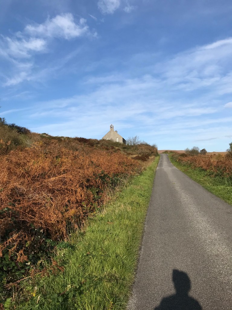
There followed another climb, this one started before Corran Sands and went up towards the church sitting at the top of the hill. The hill and the little bell tower gave it a distinct mission bell look. We we rewarded for the climb with some great views of the islands. There are five which are called Eilean nan Gabhar (Island of the Goats), Eilean nan Coinein (Island of the Rabbits), Eilean Diomhain (Idle Island), Pladda and Eilean Bhride (Bridget’s Island).
Leargybreck to Lagg
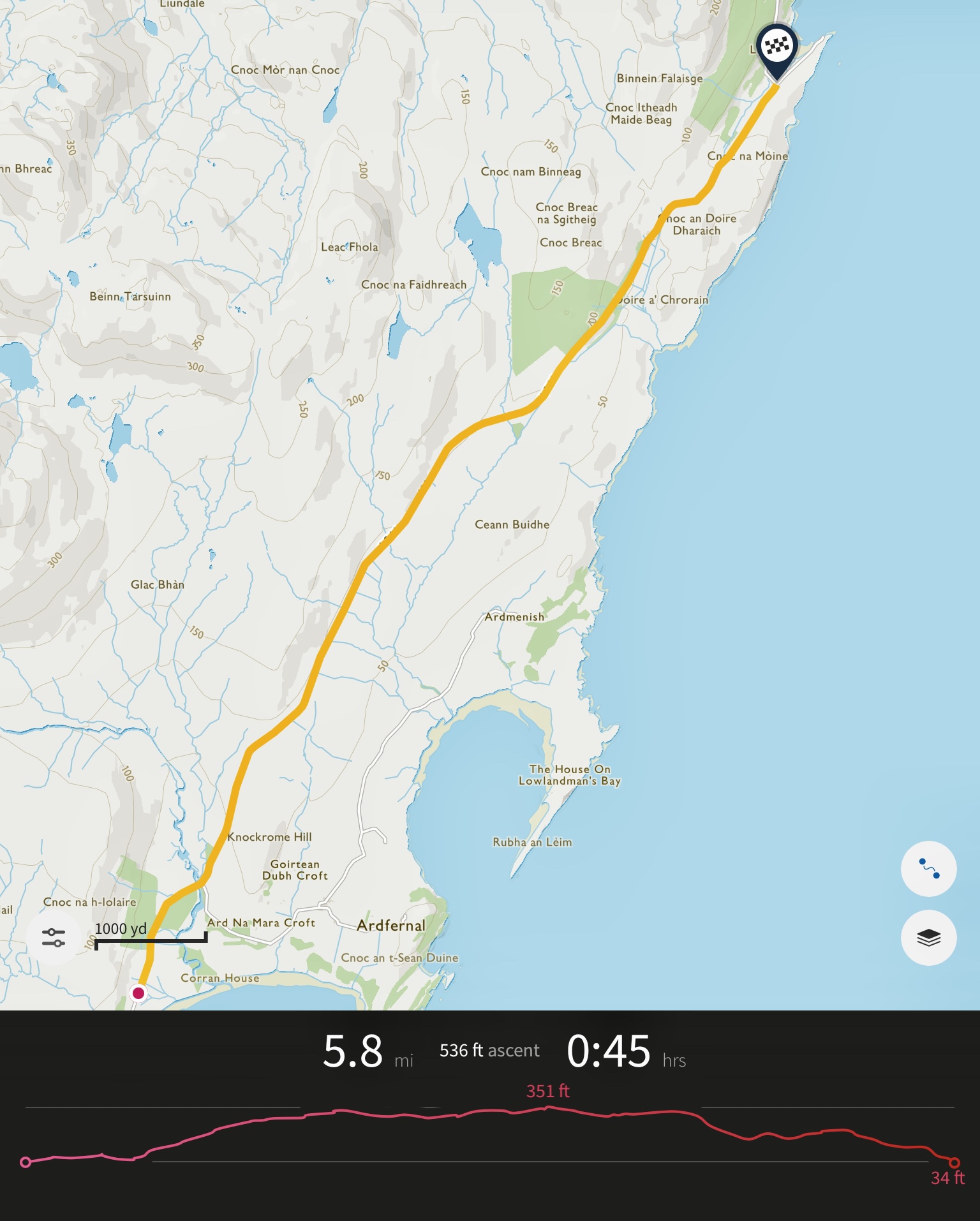
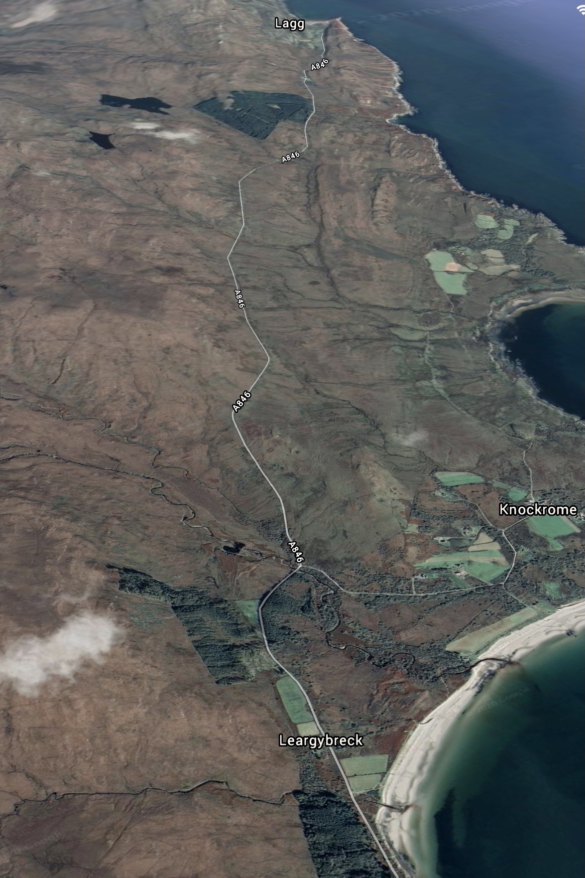
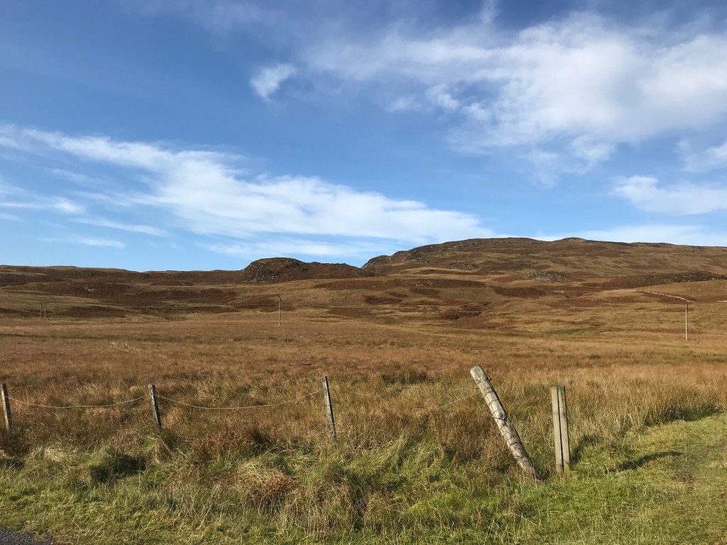
A gentle cycle out of Leargybreck and the high hills which have been obscuring The Paps the last few miles end. Suddenly the landscape opens up with The Paps coming fully into view just before a little hump bridge and then cattle grid. A right turn leads to Knockrome but we were carrying straight on.
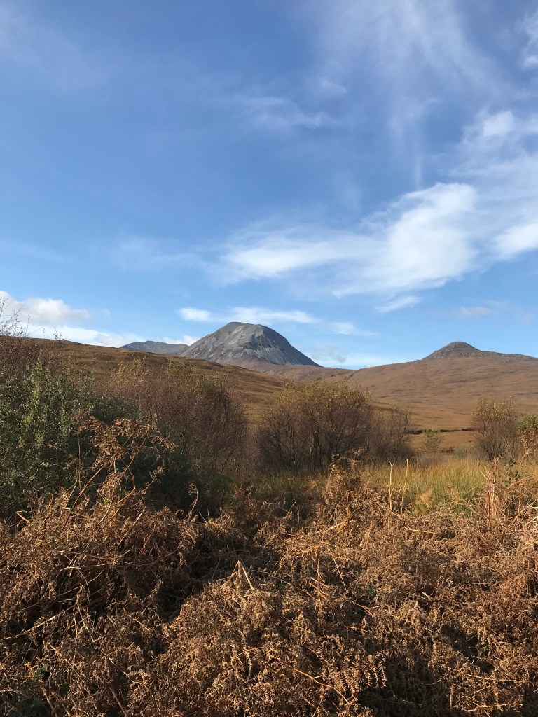
The best views of The Paps were here. The highest of these is Beinn an Òir (Gaelic: ‘mountain of gold’) at 2,575 ft, making this a Corbett.
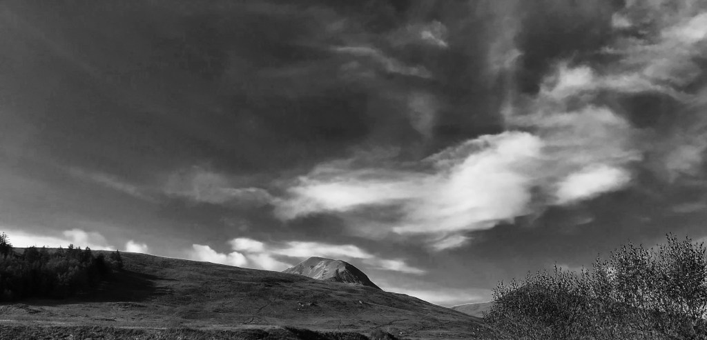
The other two Paps are Beinn Shiantaidh (Gaelic: ‘holy mountain’) which is 2,484 ft and Beinn a’ Chaolais (Gaelic: ‘mountain of the kyle’) at 2,408 ft making them both Grahams.* The Paps looked magnificent, with dozens of shades of greens, greys and blacks coming into focus at closer proximity. The quartzite range contrasting sharply with the deep autumnal oranges and browns and flecked white blue of the afternoon sky.
After that it was a long and tedious climb towards a forest which was worth it for the joy of the descent through the forest although that joy was quickly wiped out by a torturous climb towards the White House at Lagg which got even worse upon passing the house. We were definitely walking up more hills than we were cycling.
When the hill finally ended we stopped for chocolate and to take in the view looking down towards a farmhouse at Lagg which was downhill all the way. The picturesque Mac Lean cottage against the backdrop of Lagg Bay and the woodland of Doire Dubh (which translates as black oak.)
Lagg to Lussagiven
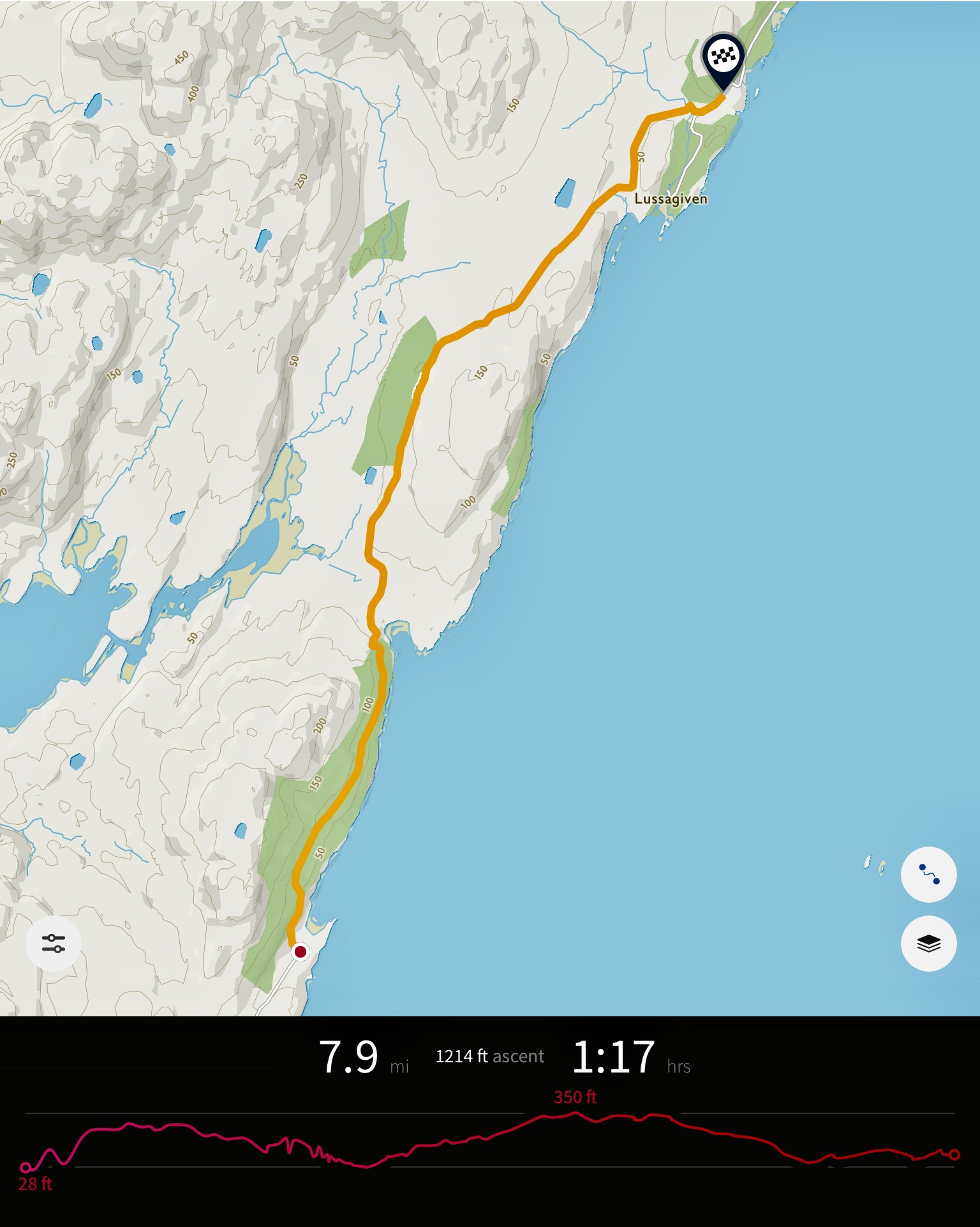
Through a farm yard at full speed and then another climb past a row of cottages.
And oh look a red telephone box just before another horrible climb, this climb carried on until we reached a small lumber yard, it was probably the worst one of the day, at this point very late in the afternoon we were all tiring. Luckily the next stretch gave us some relaxation continuing through the Jura forest.
We next reached a ruined house and then another climb.
A steep winding road with a crash barrier quite a way around here due to the sheer drop into the forest and straight down to the coast.
Once leaving the forest the climb stops and it suddenly opens up to the tiny village of Tarbert and a descent towards sea level.
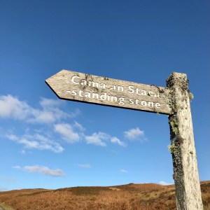
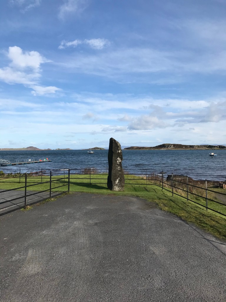
After the standing stone at Tarbert there’s another brutal climb through yet more lonely hills.
Slight rest when you reach Loch Tarbert, this Loch almost splits Jura in half and would make for a good kayaking trip to explore some of the remote beaches on Jura’s west coast. This part was brutal with a couple of big climbs. At this point after cycling for six hours you really start to feel the weight of the bike and kit filled panniers. Andrew & Sam had full rucksacks on. At one point I could barely face even a gentle climb, which turned out to be the last climb before Lussagiven.
Back to Lagg
Ten miles short of The Corryvreckan and we took the decision to head back down the island towards Lagg where we’d seen a few wild camping spots. There was perhaps another ninety minutes of daylight left but looking at the route the road into the hills towards Ardlussa and after the particularly hard cycling we’d just gone through and knowing in order to reach the ferry back to Islay we would not be able to camp at The Corryvreckan and make it on time.
We had been cycling for over six hours and it would have been at least ninety more minutes to get to The Corryvreckan. To get up and do that early on the Sunday morning was at this point not something any of us could really contemplate.
Disappointing that we didn’t reach the end but given our timescales and the punishingly long road it wasn’t that surprising. Next attempt will either be camping two nights on the island or setting up camp early on, thus losing the additional weight.
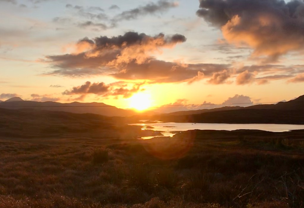
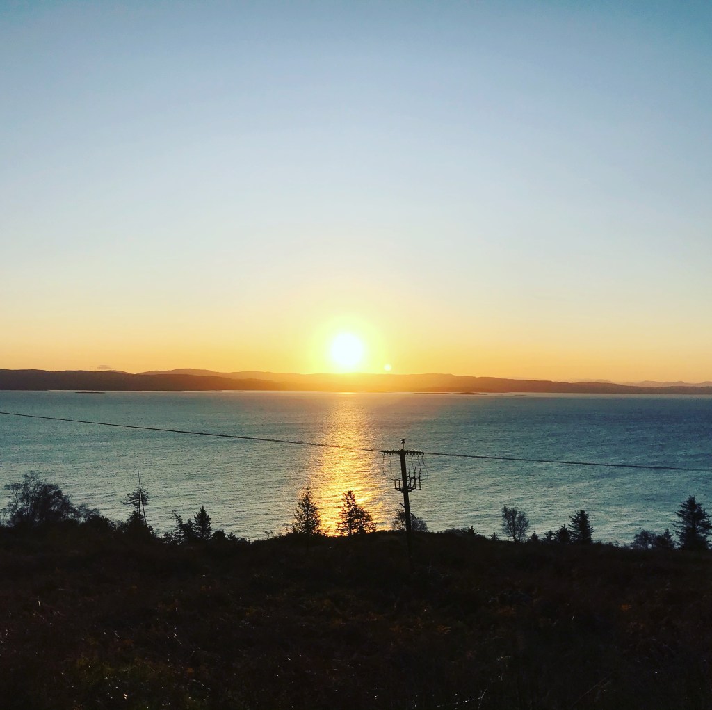
We gave ourselves another ten minutes to recuperate before getting back on the road and quickly reaching Loch Tarbert where we watched a spectacular sunset over the loch. Taking on the last few hills dusk started slowly falling onto Jura just as we reached the last stretch before a camping spot at Lagg. I collected firewood whilst Sam and Andrew set up camp.
*Scottish Mountain classifications
Munros are mountains over 3,000 feet in height. There are 282 of these.
Corbetts are Scottish hills between 2,500ft to 3,000ft in height and with a drop of 500ft on all sides. There are 221 Corbetts.
Grahams are hills between 2000ft-2500ft in height with a drop of 150m on all sides. There are 224 Grahams.
Donalds are hills in the Scottish Lowlands with a height of 2000ft and over and with ‘prominence of 100ft or more. There are 89 Donalds.
A Marylin is any hill in the UK and Ireland with a drop of 150m on all sides. There are 1218 Marilyns in Scotland.
