My initial idea for this trip had been to cycle from St Margaret’s Hope or Stromness to Skara Brae and then cycle on to Kirkwall. From there you can catch the overnight ferry to Lerwick, arriving seven thirty am the next morning.
After that I’d keep cycling north via the islands of Yell & Unst to Skaw the northernmost settlement in the UK. I’d be wild camping all the way which meant considerable extra weight in my panniers. It would be four days in total but timing the ferries proved difficult and I’d left it too late
In the end I was rather pleased the Shetland trip didn’t happen this time as I would have seen so much less of Mainland Orkney with so many of its islands left to explore.
As an aside the northernmost point in the British Isles was often said to be Muckle Fugga and it’s true it was the northernmost inhabited island. In 1995 when Muckle Fugga’s lighthouse was automated the northernmost inhabited island became Unst but the northernmost point has always been Out Stack or Ootsta, an islet 600m NE of Muckle Fugga, sometimes called the full stop at the end of Britain. North of here heads into the Norwegian Sea and further on the Arctic Ocean.
Day One – John o’Groats
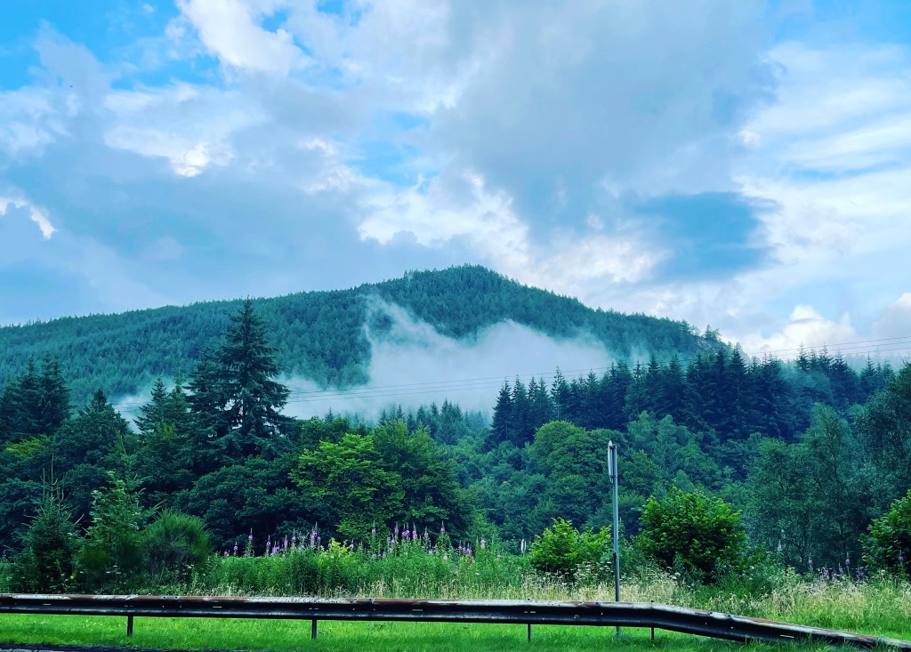
A six hour drive lay in front of me as I departed Glasgow on a cloudy Monday afternoon by the time I reached the Tay Forest and pulled over it was a light happy drizzle releasing an amazing forest fragrance.
Sometimes I forget how much I adore that scent and it’s only when back in those heady moment do I remember how much it means. Maybe we all forget those ancient links hard wired into our DNA from time to time?
The smell is known as Geosmin (earth smell) and it comes from bacteria in the soil. It’s still not known exactly why that happens but this article hypotheses further.
The Smell of Rain: before, during, and after.
Interestingly that same scent is used by many parfumiers to create earthy smells in perfumes. It made me want to pitch right there and sleep in the forest, though tempting as the Tay Forest was I faced a four hour drive that I didn’t want to make early the next morning.
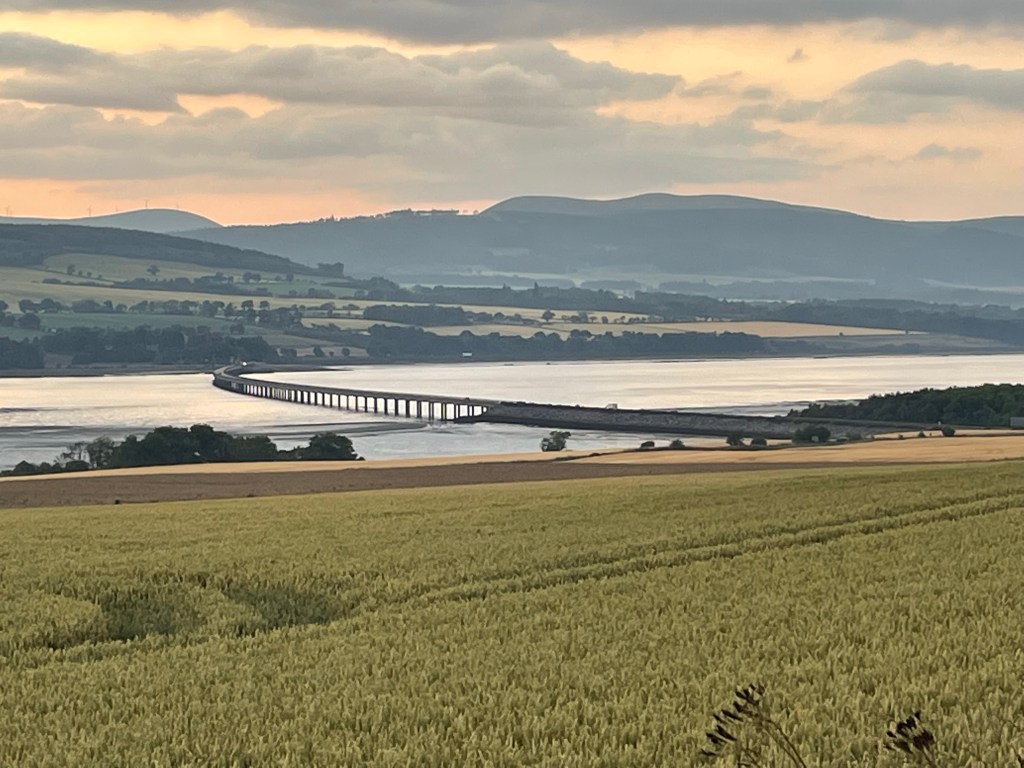
Onward then through the Cairngorms towards Inverness. One moment you’re driving through the never ending vast landscapes of the national park which abruptly ends as you descend towards Inverness.
Passing quickly through Inverness just after nine pm with three hours and 133 miles remaining, I’d have daylight for maybe an hour as I trundled my way up the A9 towards Wick. This part of the trip with the fading light, not able to see much of the coast at all was tedious. Small seemingly deserted villages pop up every now and again.
I pulled over at a rather deserted Wick around midnight to Wick Retail Park. A reasonable size with a number of high street retailers which was the most brightly lit shopping centre car park I’ve ever been to. Brighter than The Trafford Centre at Christmas, great that I could fill my windscreen wash in what was practically daylight, but really? It needed to be that bright? At midnight? In Wick???
Quick stretch of the legs and it was back at the wheel, it’s the last twenty minutes of the trip as I turned off onto the A99, a torturously slow A-road in the complete darkness that had fallen on leaving the comparative city lights of Wick behind. My speed had fallen down to 20 miles an hour now, full beams lighting up what felt like hundreds of thousands of moths dominating the road on the final approach to the northernmost settlement on mainland UK.
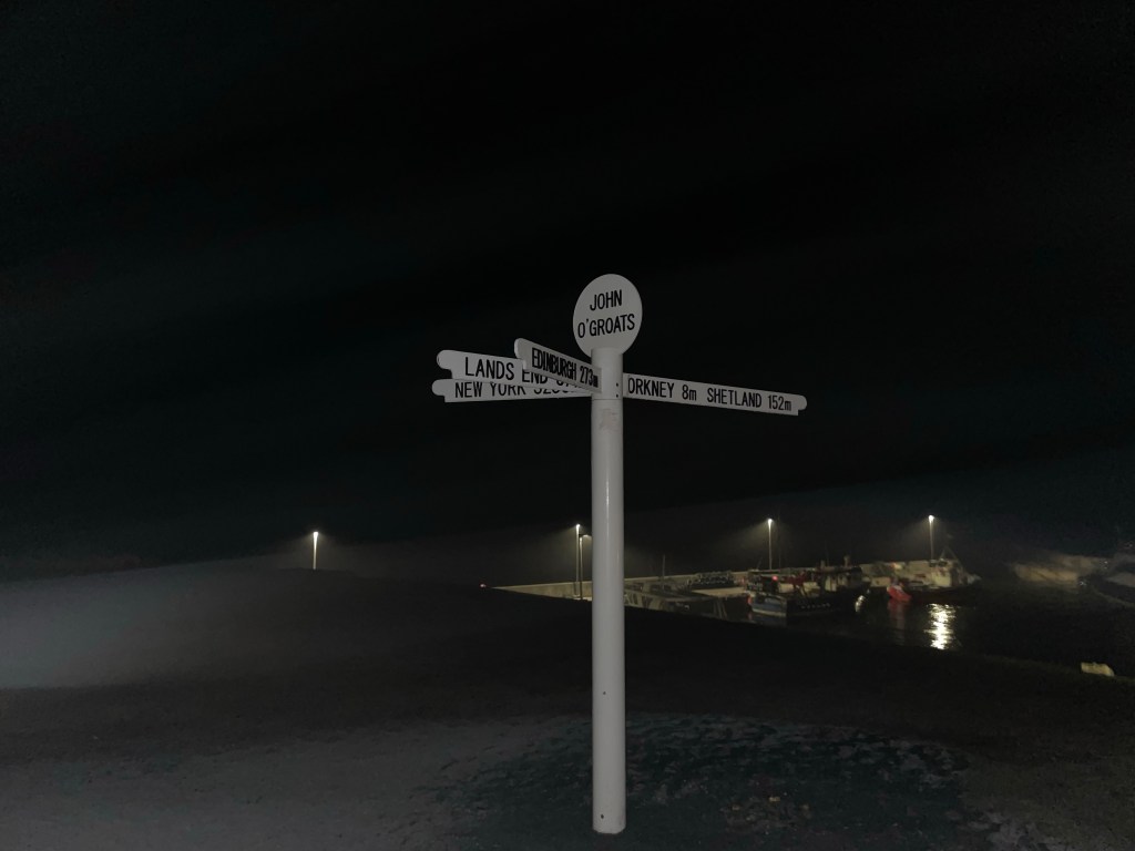
John o’Groats after midnight? Closed for the night. The road finally ending without even a hint of fanfare on a large car park.
At least this time the sign was in its rightful place, I had visited ten years earlier and the sign had been put away for the night due to tourists throwing it into the sea. Weird.
St Margaret’s Hope
The long drive to John o’Groats arriving shortly after midnight with an uncomfortable sleep and a 9am start left me groggy, wanting coffee and needing aspirin as I boarded the nine am ferry from Gills Bay on the mainland to St Margaret’s Hope on South Ronaldsay. It’s a small port five minutes from John o’Groats but plenty of free parking.
The ferry appeared suddenly (like Inverness) through the mist and light morning drizzle which set the tone for the hour long crossing. I did try and spend sometime on the observation deck but it was more than a little dreich and I sadly managed only five minutes.
The onboard cafe opened shortly after boarding. I quickly woke myself up with coffee. Landing at St Margaret’s Hope exactly on time I soon saw the post office and resolved the aspirin issue. Note to self, these should have been more accessible than buried deep inside the panniers.
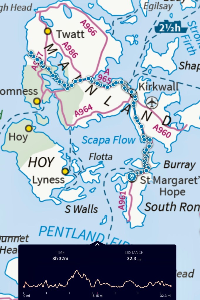
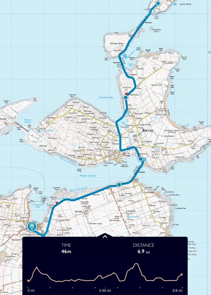
South Ronaldsay is the first Orkney island you land on via this route The above route shows three and a half hours but I planned to stop at the Italian Chapel, Kirkwall, Standing stones of Stenness and the Ring of Brodgar. The stops I planned plus the extra weight on the bike and I estimated I’d arrive at Skara Brae between six and seven.
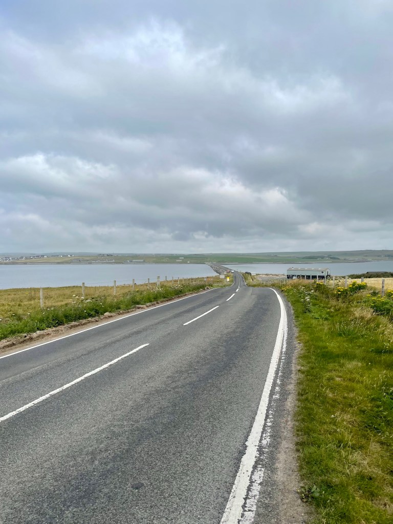
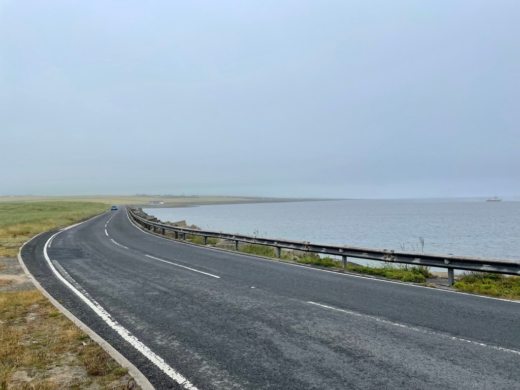
Within 20 minutes I’d left St Margaret’s Hope and crossed Churchill Barrier No. 4 which took me onto the island of Burray. I’d intended taking a detour and visiting Hunda, another island linked by a causeway to Burray. I somehow missed the turning and was already approaching Churchill Barrier No. 3 which led to Glimps Holm.
I decided to press on and catch Hunda on the way back tomorrow, this turned out to be a mistake.
St Margaret’s Hope to Lambs Holm
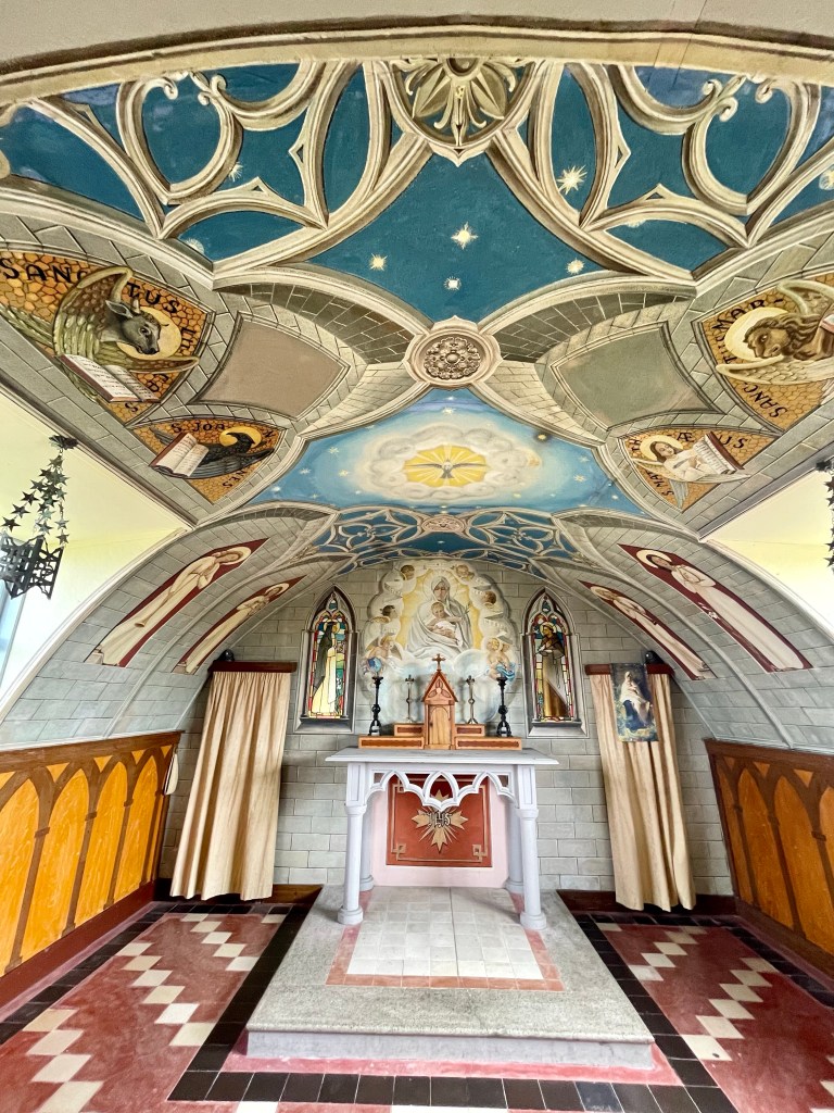
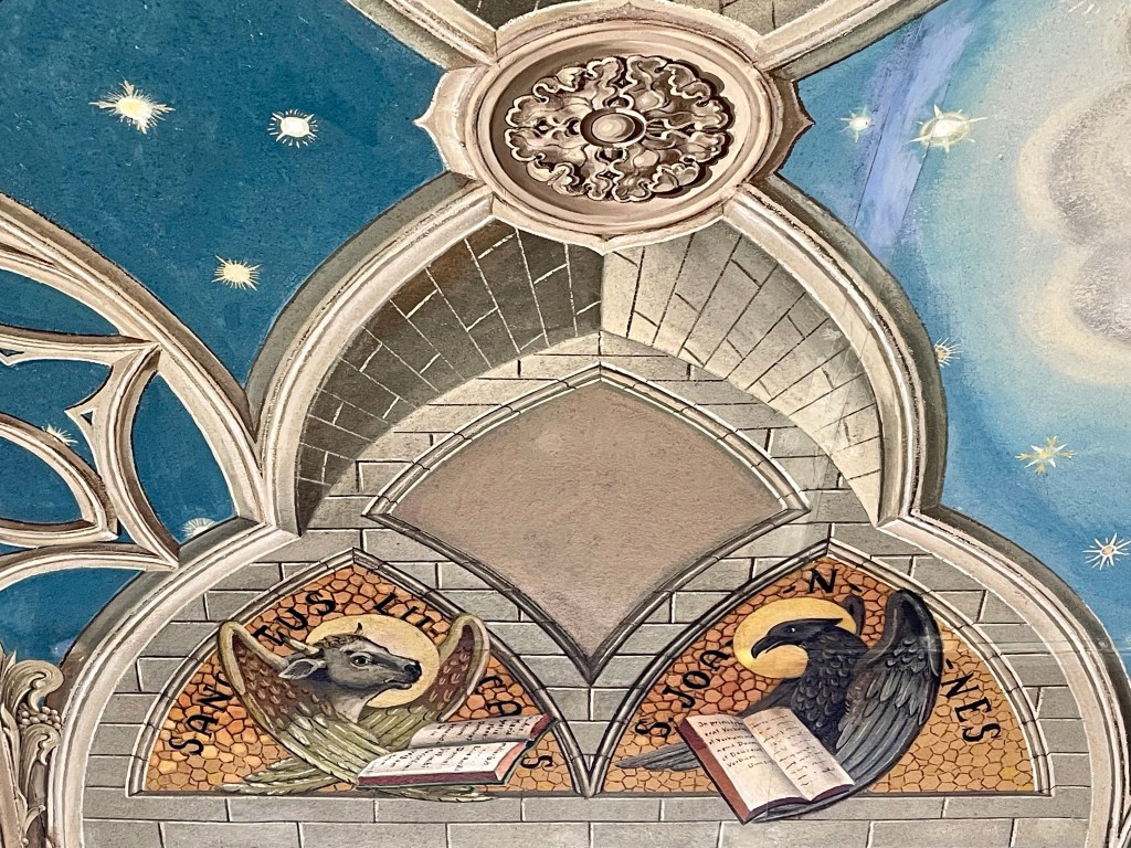
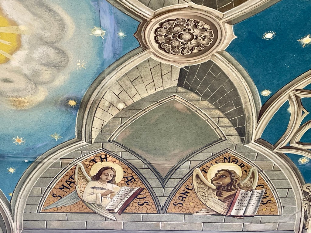
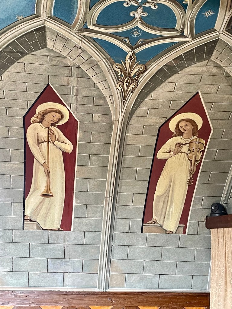
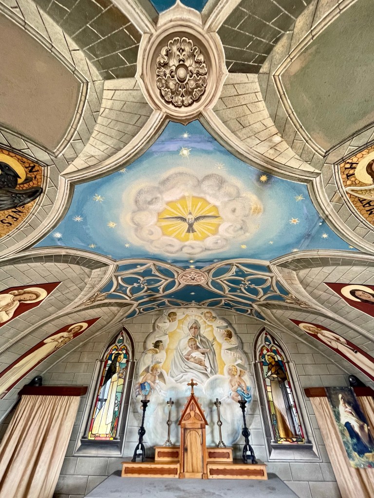
Italian chapel
Arriving as planned on the uninhabited island of Lambs Holm at lunchtime I quickly parked up my bike inside the chapel garden. It’s quite a magnificent sight, unfamiliar and at odds with the Scottish landscape yes, but a familiar sight to anyone with even a passing familiarity with western movies. The whole ‘There she stood in the doorway, I heard the mission bell and I was thinking to myself I should probably go around the outside now.
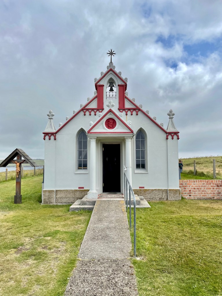
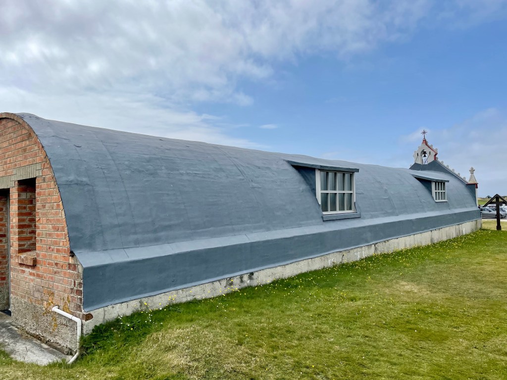
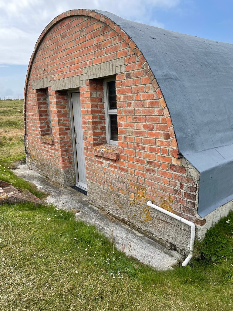
I walked down the side of the chapel to see behind the curtain, far from being at all disappointed by the ordinariness of it. I felt more amazed by how these men had built something so beautiful, mainly out two Nissen huts joined together in such challenging conditions with little resource and in their free time.
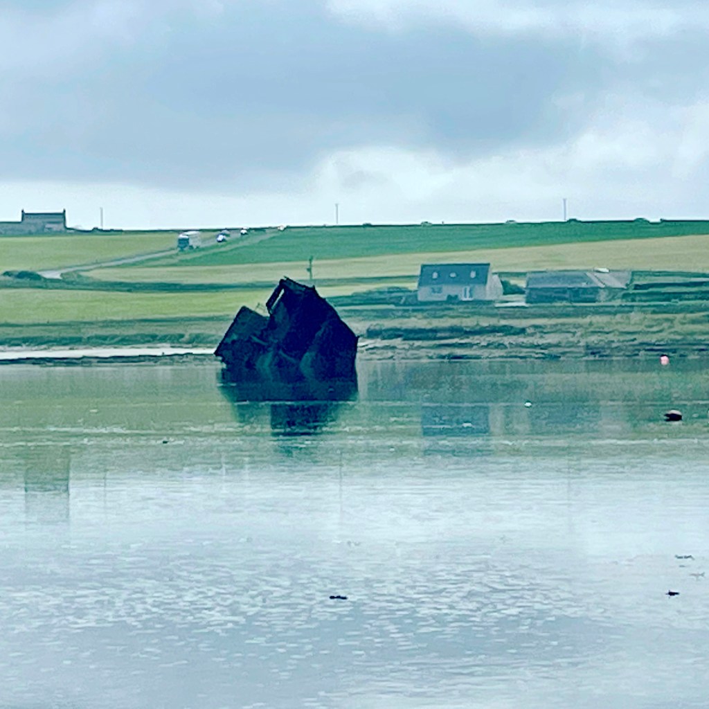
550 Italian prisoners of war, captured in North Africa were brought to Orkney in 1942. They worked on the construction of the Churchill Barriers, four causeways created to block access to Scapa Flow which was Britain’s main naval base during both world wars. A German U boat had got into the bay and sank HMS Royal Oak in 1939 so Churchill ordered the construction of 4 causeways which would blockade one side of Scapa Flow.
There is an argument this breached the Geneva Convention in that POW’s are not allowed to be made to work on war efforts but the government claimed this was essential communication work it also seems the men may have been paid for their efforts. It’s also true that the barriers did improve communication between the islands.
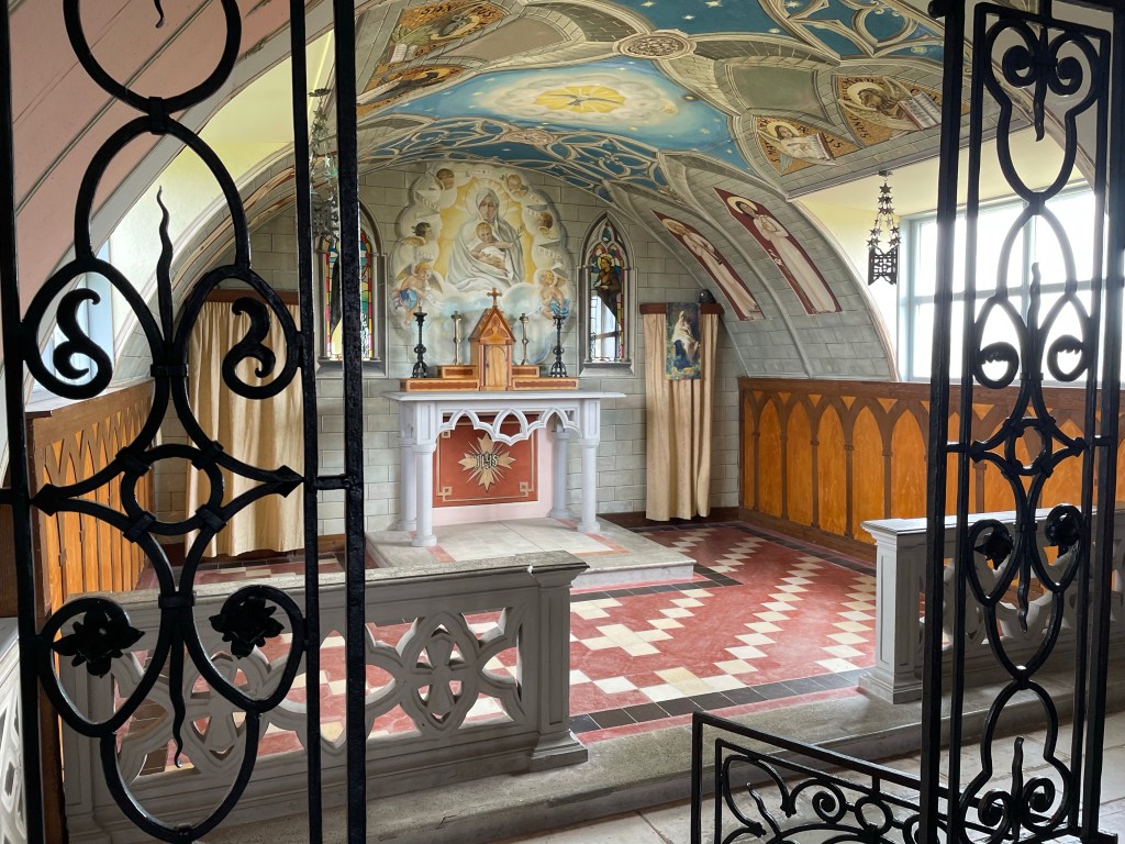
Much of the interior decoration was done by Domenico Chiocchetti who remained on the island to finish even after his fellow prisoners were released, shortly before the end of WWII. Domenico would visit Orkney twice more in 1960 to undertake some essential repairs to the chapel and in 1964 with his wife.
Domenico also wrote a letter to the people of Orkney in which he said. “The chapel is yours – for you to love and preserve. I take with me to Italy the remembrance of your kindness and wonderful hospitality. I shall remember you always, and my children shall learn from me to love you. I thank (you) . . . for having given me the joy of seeing again the little chapel of Lambholm where I, in leaving, leave a part of my heart.”
1910 – 1999
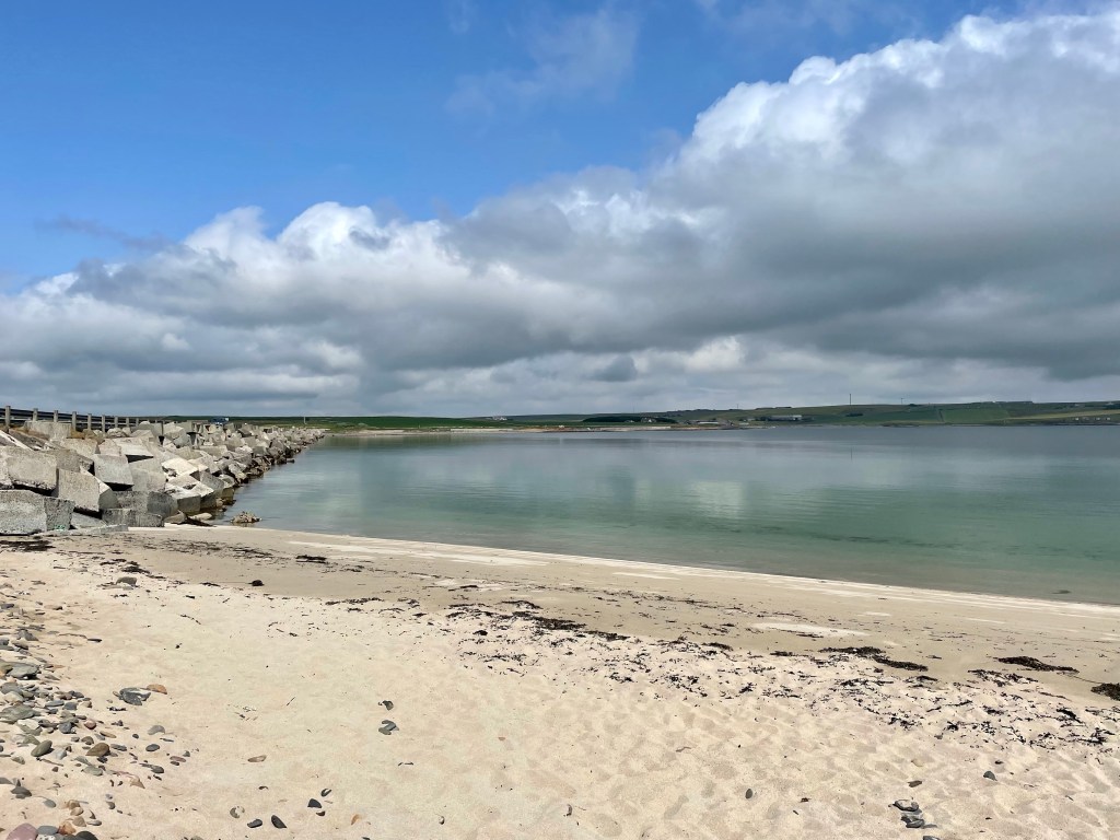
Leaving the chapel I saw a small beach just before the road towards the mainland which was the perfect spot for lunch.
Kirkwall
One of the hills on the approach to Kirkwall was particularly brutal and I was soon off the bike and walking to the top. I certainly wasn’t firing on all cylinders yet and my legs were struggling a little, sometimes feel I’m not at my best straight off the ferry and into the cycling or maybe the weight of the kit in my panniers. I’m not the best morning person either.
In general the roads weren’t that busy and all the drivers I encountered were friendly and courteous. I did struggle on a few hills and when I needed to I would pull in and get my bike well off the road. Likewise if I ever felt there were cars queuing to get past me I’d pull in wherever I could.
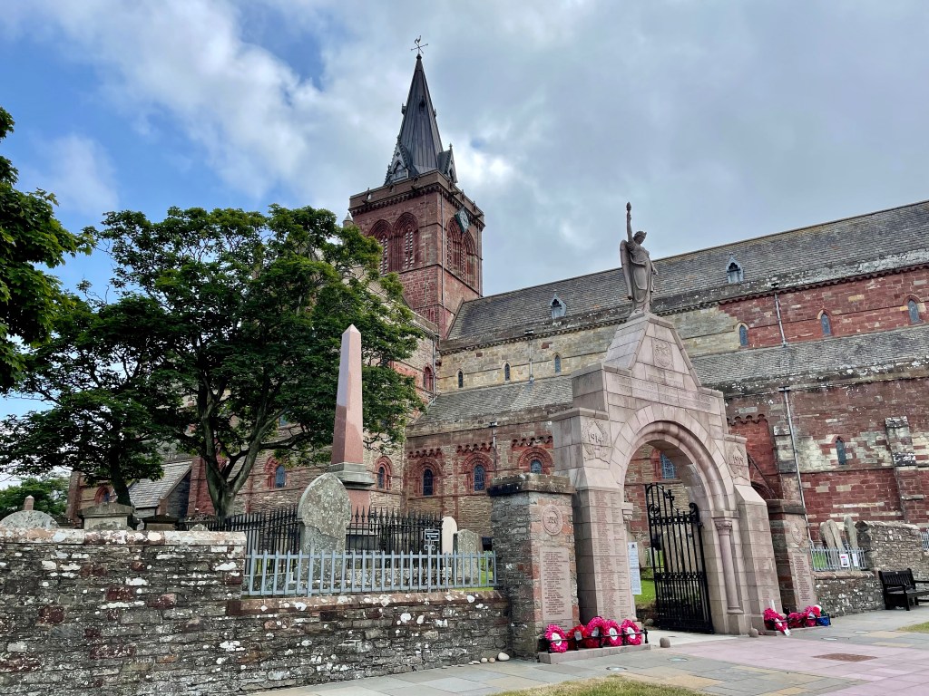
The most northerly cathedral in the United Kingdom and a fine example of Romanesque architecture. Construction started in in 1137 and was added to over the next 300 years.
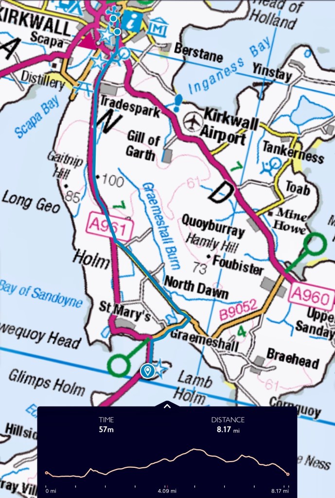
Lambs Holm to St. Magnus Cathedral
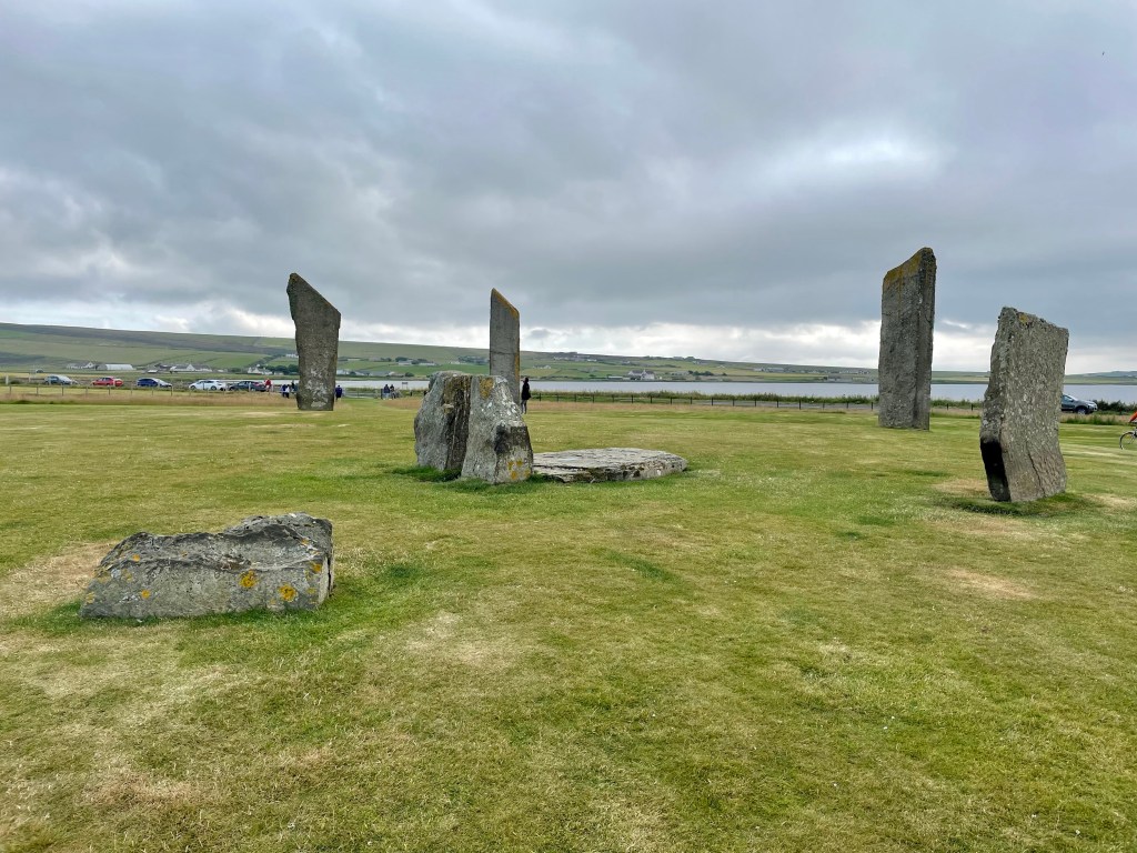
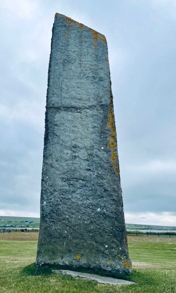
Standing Stones of Stenness
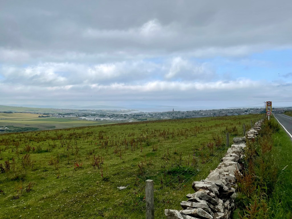
Leaving Kirkwall I took the Bay of Firth coast road to Finstown. A few tight corners on the approach to Finstown as traffic significantly increased. I stopped for coffee and noodles at a picnic area. Roughly another five miles to the first set of standing stones.
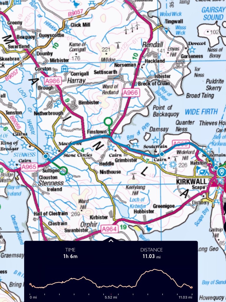
St Magnus Cathedral to Standing stones of Stenness
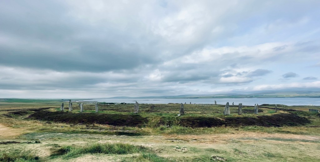
Ring of Brodgar
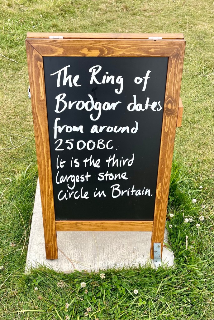
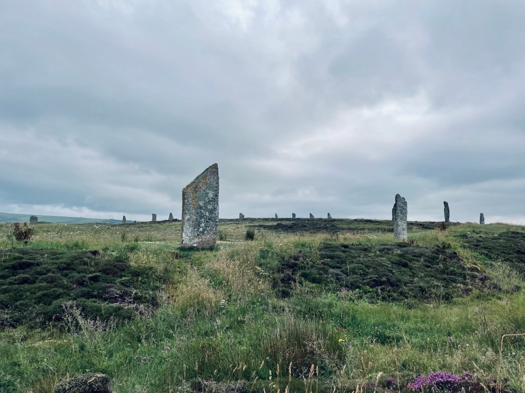
The Ring of Brodgar (or Brogar, or Ring o’ Brodgar) is a Neolithic henge and stone circle in Mainland, Orkney, Scotland. It is the only major henge and stone circle in Britain which is an almost perfect circle. Most henges do not contain stone circles; Brodgar is a striking exception, ranking with Avebury and Stonehenge.
The site has resisted attempts at scientific dating and the monument’s age remains uncertain. It is generally thought to have been erected between 2500 BC and 2000 BC
Bay of Skaill
Arriving at the Bay of Skaill on Tuesday night I set up my small camp in the dunes. There are facilities nearby but still out of sight of any houses so it isn’t too wild of a camp. There were a few cycles & tents dotted about on the beach.
You maybe not unsurprisingly given the location next to a place that was built before the pyramids start imagining Neolithic people running onto the beach, perhaps children or perhaps fishermen.
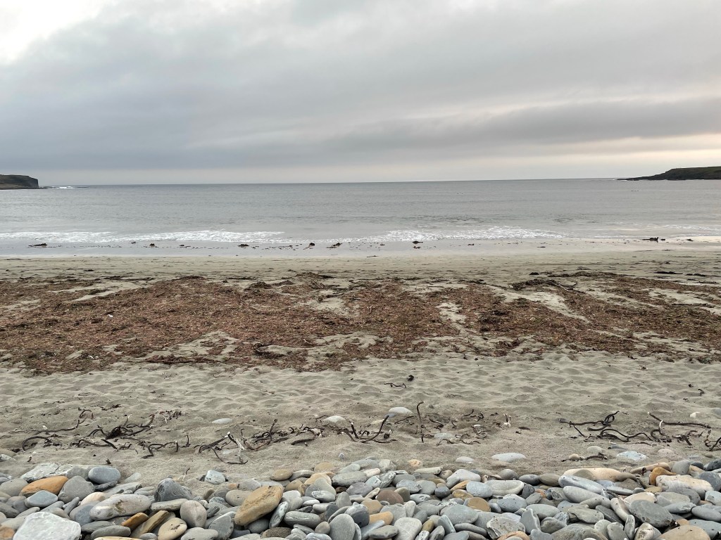
Unfortunately this wouldn’t be quite right as during its inhabitance it was about half a mile from the sea, erosion having cut through the headland. Whilst there would have been hunters and no doubt children appearing on the beach it wouldn’t have been the skipping & frolicking from their front door gaily across the pebbles and onto the sands.
The two headlands were once joined together, a freshwater loch behind all now now completely gone due to centuries of coastal erosion.
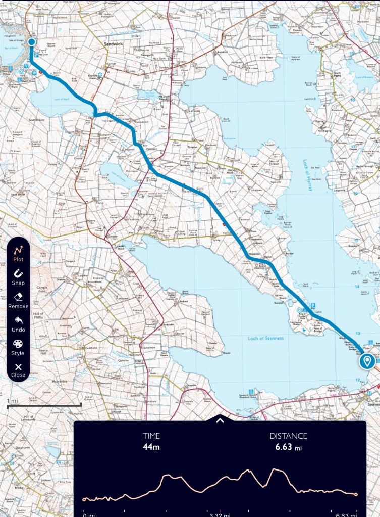
Standing stones of Stenness to Bay of Skaill
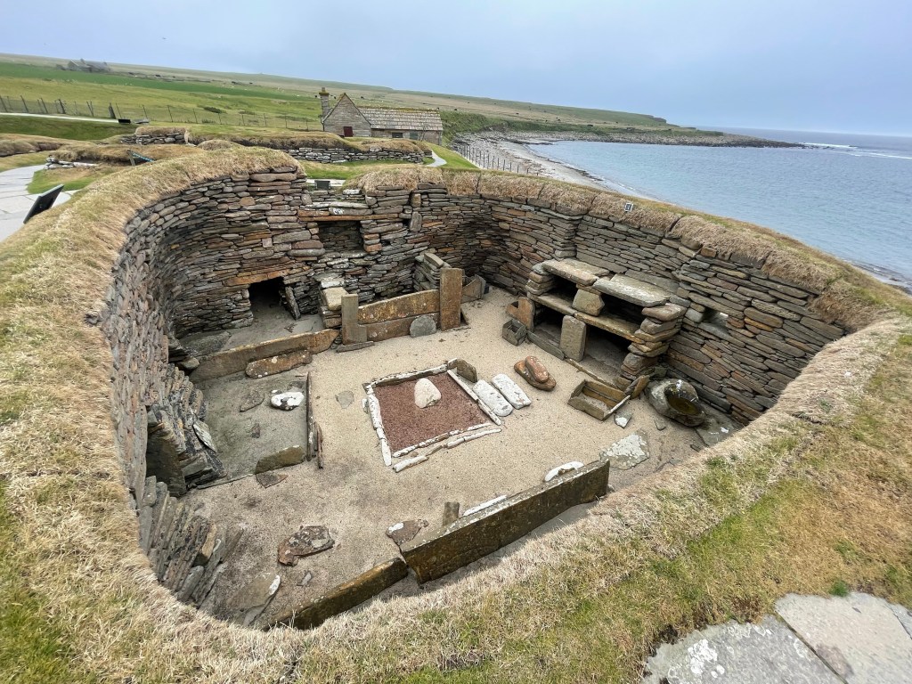
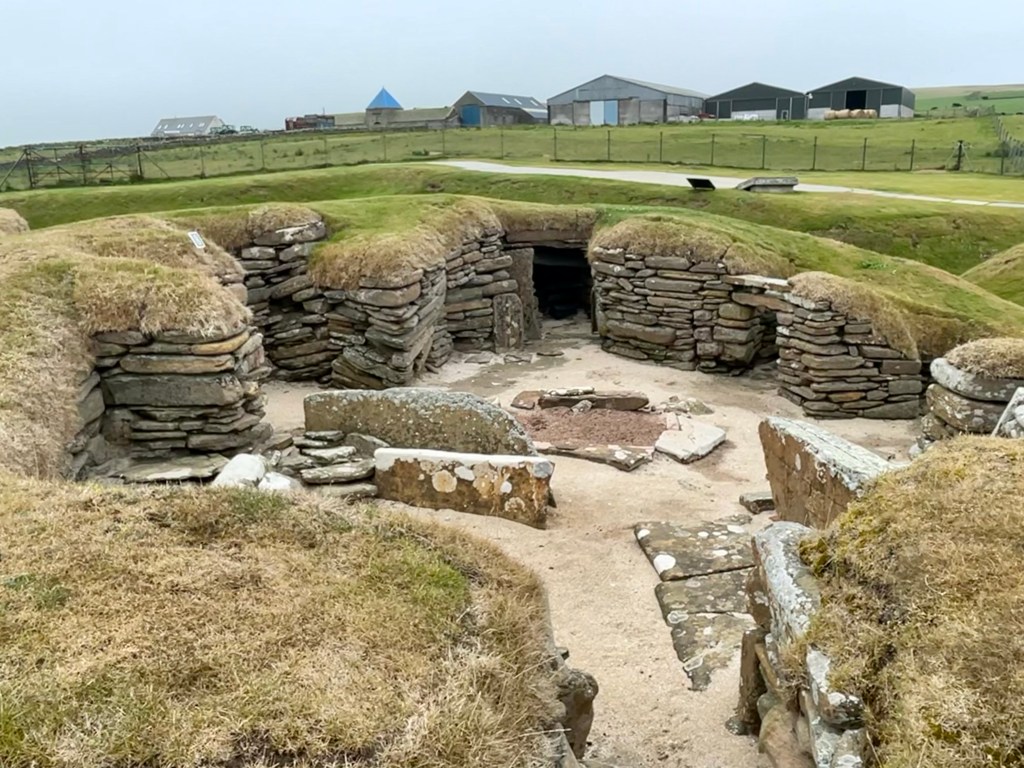
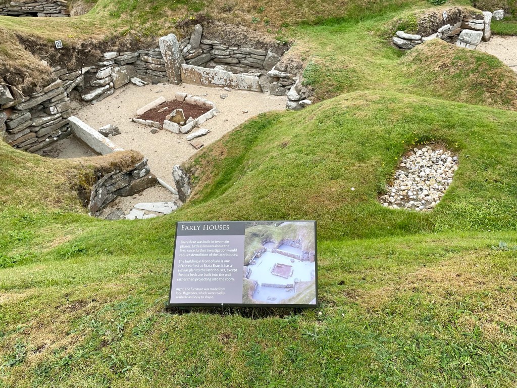
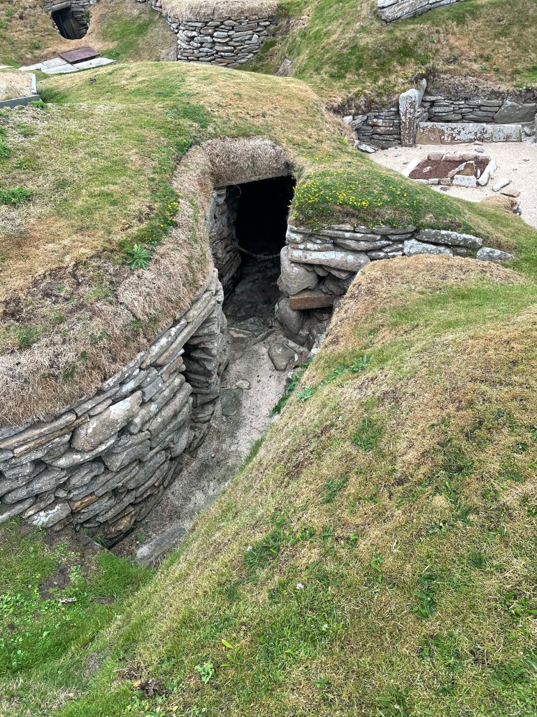
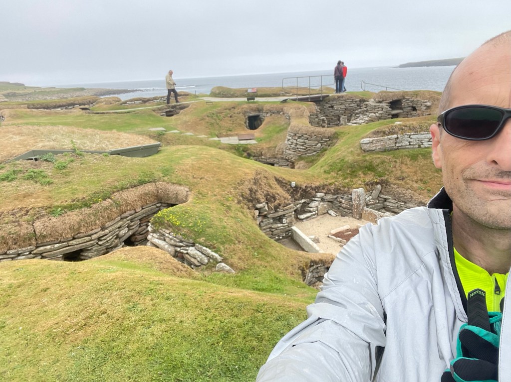
Day Two – Skara Brae
From the first moment I saw those two words reading maps as a child I’d wanted to go, maybe it was the similarity of that word to Skaro, which was the Dalek home planet in the Doctor Who series.
The name left an imprint in a similar way that Westward Ho! or Cape Wrath but more than that the ‘Sk’ are quite boldly old Norse when so often we see less obvious suffixed names, of course Grimsby and Snaefell. Leading with Sk gives it something extra. Skara Brae had left these indelibly romantic, windswept and far edge of the kingdom images.
I later found out that it only really began to be called Skara Brae in the 1950’s before that it was known as Skerrabra.
In the winter of 1850, a great storm had battered Orkney. The combination of wind and extremely high tides stripped the grass from a large mound, then known as “Skerrabra”. This was when the Laird, William Graham Watt then discovered the site and began excavating.
Skara Brae is also mentioned in the writings of George Marwick 1836 – 1912 a writer and folklorist from the nearby hamlet of Yesnaby. George mentions “Skara Brae” several times albeit calling it Skerrow Brae and in another story Skawhowe.
In his book, ‘Observations made in a Tour of the islands of Orkney and Shetland in the year 1769’ James Robertson notes ‘square catacombs at the Downs of Skaill’ in which a skeleton had been found sword in one hand Danish axe in the other.
https://en.wikipedia.org/wiki/Grooved_ware?wprov=sfti1
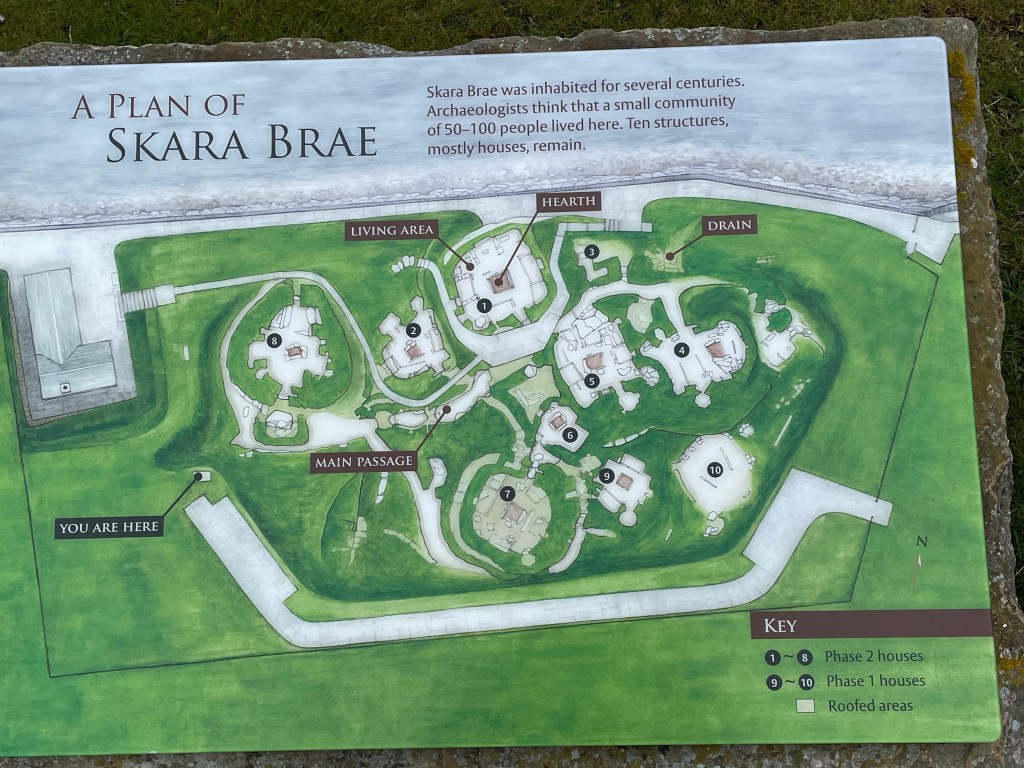
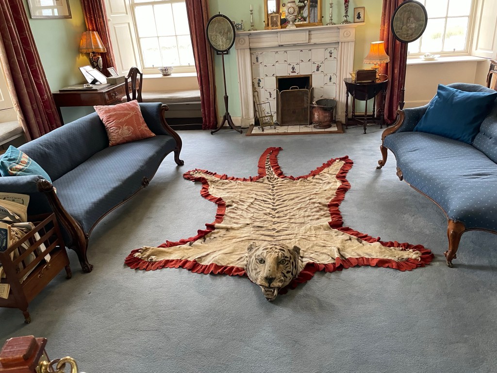
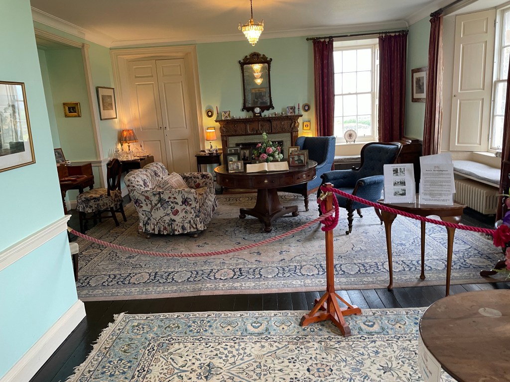
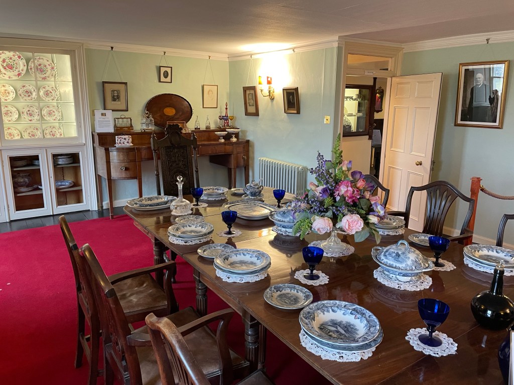
Skaill House
The 7th Laird William Graham Watt was Laird for 56 years. Watt discovered Skara Brae after a storm in 1850 and excavated 4 houses in the Neolithic village. The Manor House is described by Historic Environment Scotland as the “most complete 17th century country mansion in Orkney”.
Remarkably odd place.
Honestly I only went in because it was five minutes up a track, it was free and I wanted to be out of the drizzle and cold for ten minutes.
Midday and I now faced a thirty mile cycle to Glimps Holm where I intended to camp before getting the ferry back to the mainland the following day. Over coffee at Skara Brae I decided to head back a different route. It looked slightly easier than yesterday plus I wanted to cycle around Scapa Flow.
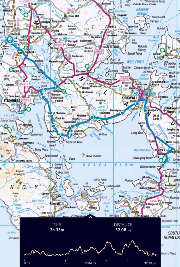
Skara Brae to Glimps Holm
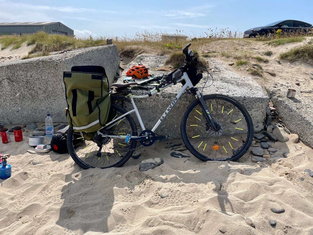
Cold and damp leaving Skara Brae and it was head down cycling the coastal road along Scapa Flow. The previous days exertions had left me more tired than I anticipated. Thirty miles with the bike kit weight and hills of Orkney is draining so the going was slow and in the main my speed was between 5 to 6 miles and hour.
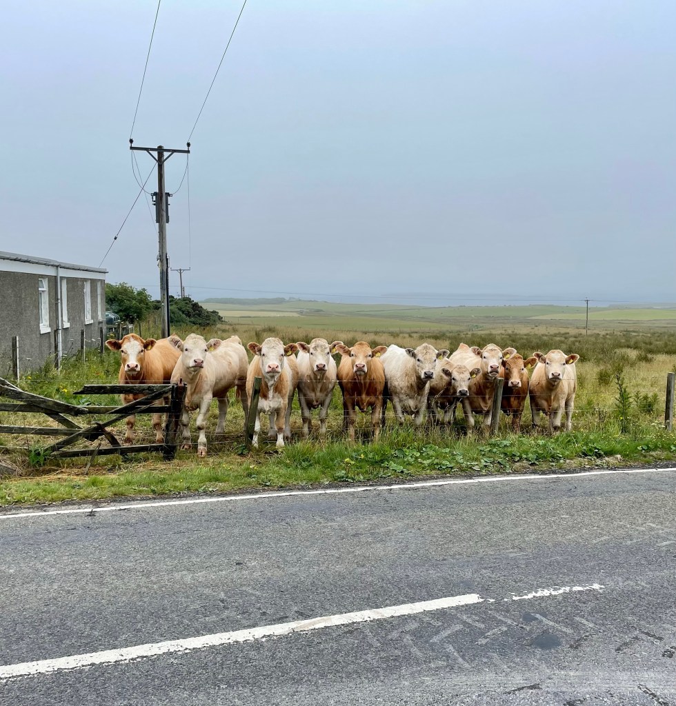
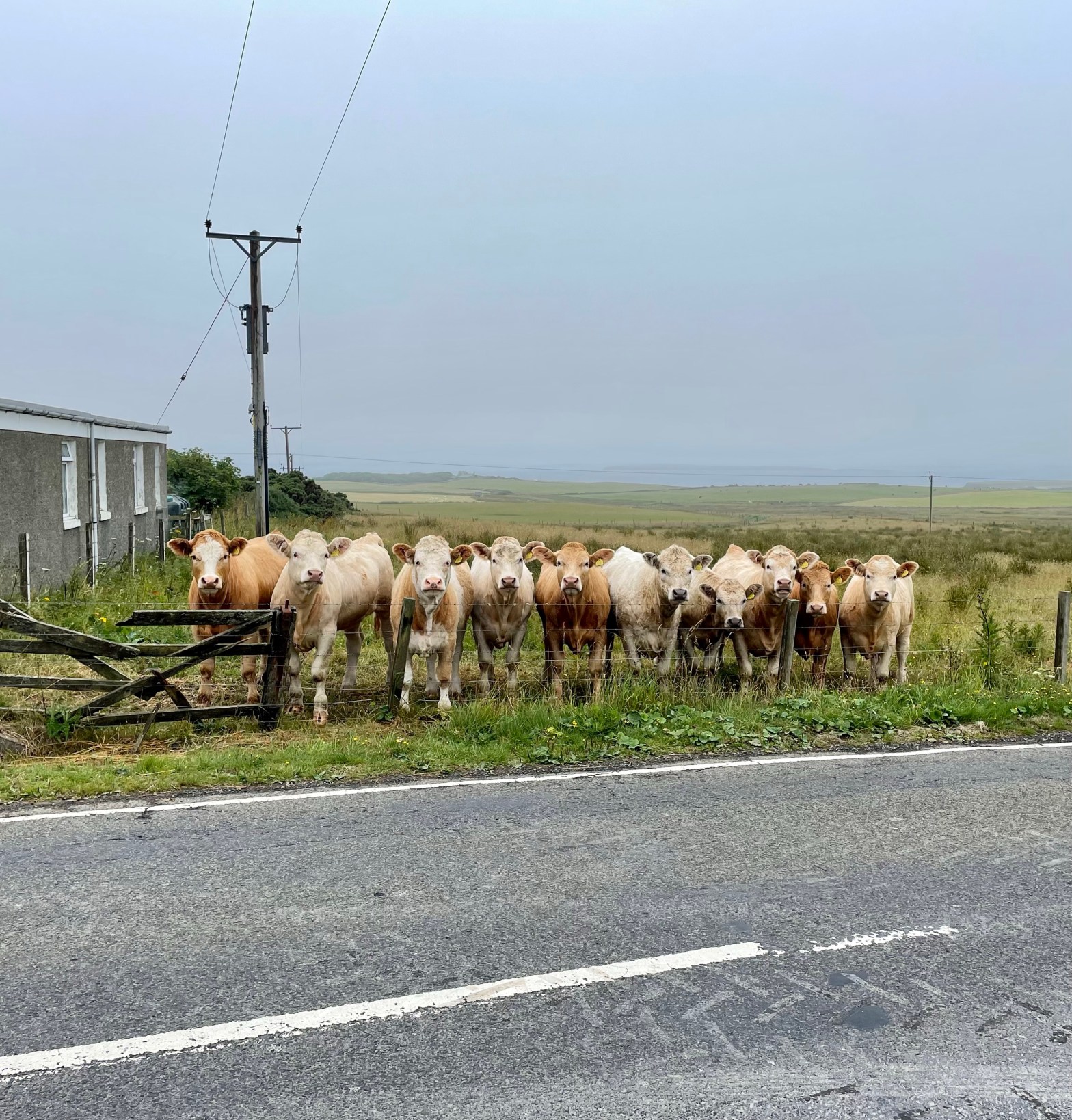
Orkney cows are unlike any other cows I’ve encountered in the U.K. I can’t recall a single time a cow took any interest in me at all, then I stopped to eat a chocolate bar at Orphir where ten cows salivated watching me open said chocolate bar and continued watching me eat. They seemed to have so much personality and an almost willingness to communicate.
Finally reached Glimps Holm at 7pm. I quickly pitched on a large patch of sand behind the machair and out of sight of the road. At this point I was too exhausted to even eat. Flopping down on the sand I lay still for thirty minutes contemplating how much I actually wanted a hot drink or even food. In the end it was orange juice, peanuts and asleep before eight.
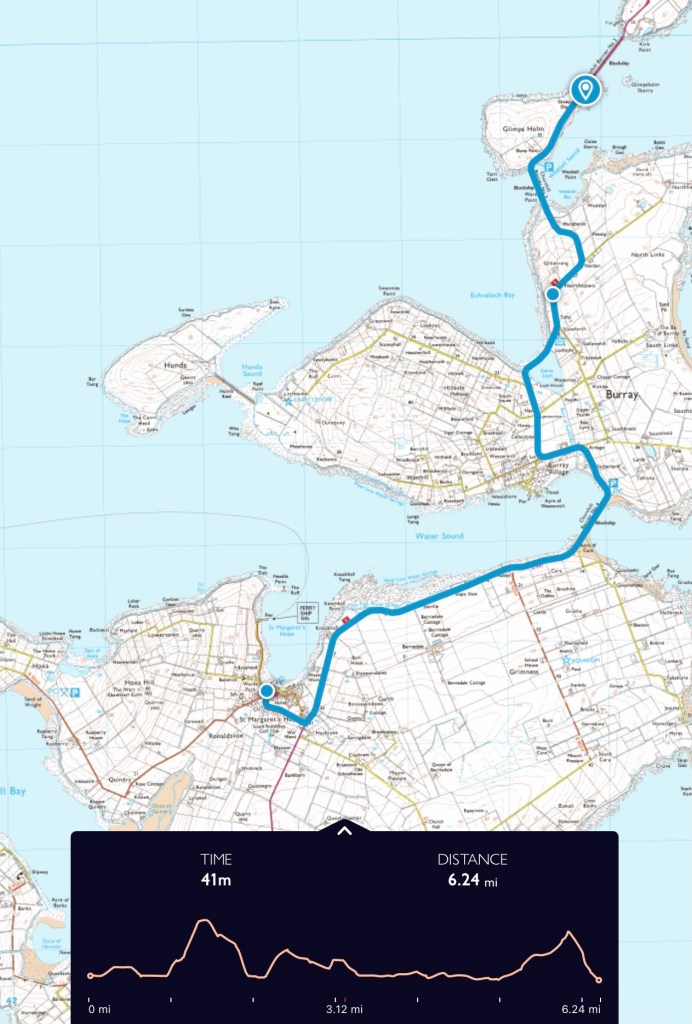
Day Three
Packing up early on day three I was slow and aching but I knew I only had six miles to go, the question was whether to take the short detour to Hunda which would then be the 21st Scottish island I’d visited.
The first hill on Burray put paid to that notion. Whilst I had enough energy to get me back to St Margaret’s Hope on time for the 11.30 ferry I had no energy to spare. Sixty miles over two days is demanding and exhausting. Twenty one would have to wait.
The Smell of Rain: before, during, and after.
https://en.wikipedia.org/wiki/Extreme_points_of_the_British_Isles?wprov=sfti1
https://www.undiscoveredscotland.co.uk/eastmainland/italianchapel/index.html
